Andy White Anthropology
  • Home
  • Fake Hercules Swords
  • Research Interests
    • Complexity Science
    • Prehistoric Social Networks
    • Eastern Woodlands Prehistory
    • Ancient Giants
  • Blog

An Update on the Kirk Project

3/6/2017

 
Without thinking about it too hard, it seems like a disproportionate amount of my work on the early hunting-gathering societies of the Eastern Woodlands has been done in the company of sick children. Today's update on the Kirk Project comes to you from a crowded chair, with my typing arms constrained by the presence of a 3-year-old in pajamas watching Fireman Sam. For the full effect, play this in the background while you read this post.

I have four updates, one of which includes an apology.

Picture
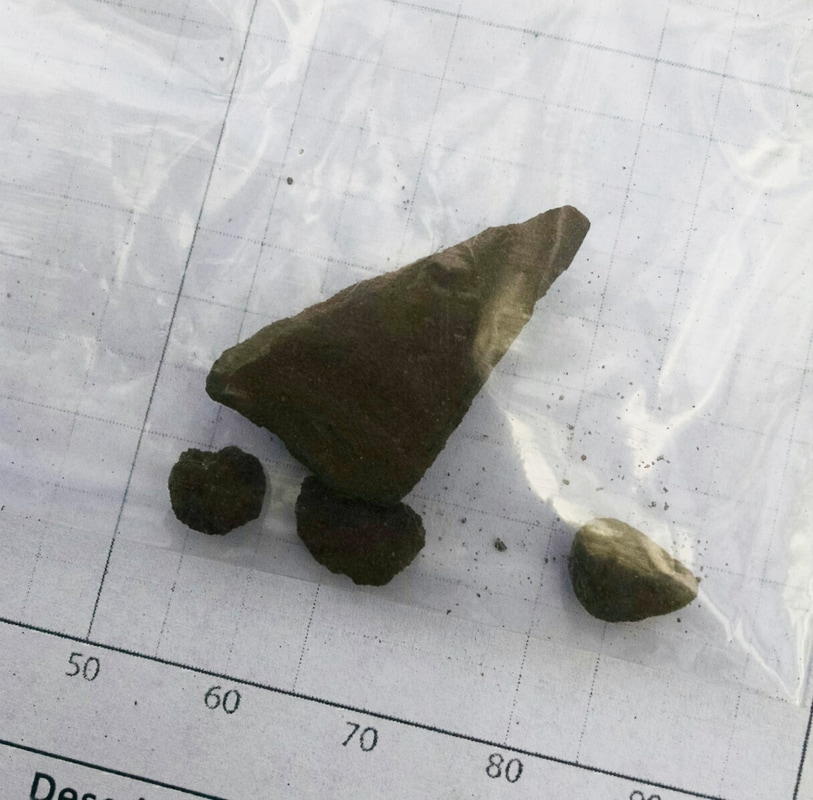
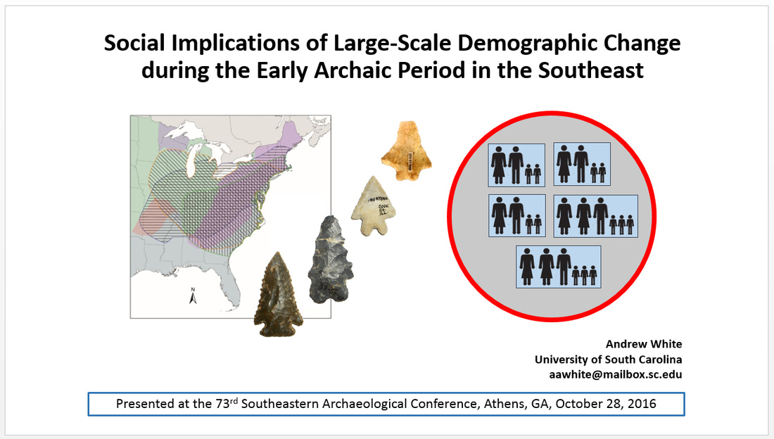
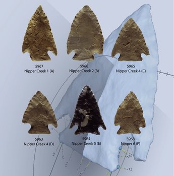
South Carolina Antiquities Paper

The first salvo of analysis related to the Kirk Project comes in the form of a paper in South Carolina Antiquities titled "A Preliminary Analysis of Haft Variability in South Carolina Kirk Points." The paper uses morphometric data from 46 Kirk points, considering shape variability in the haft regions and asking which dimensions of that variability are most likely to be linked to change through time. The majority of the points are from the Larry Strong collection (from Allendale County, South Carolina), a surface assemblage that was presumably created over a long span time of time. I compare variability in the Larry Strong points to variability in points from the Nipper Creek cache (Richland County, South Carolina), which was presumably created over a very short period of time. You can find a link to the paper on my Annotated Journal Articles page. Eventually I'll add files with the data I used in the analysis.

Picture
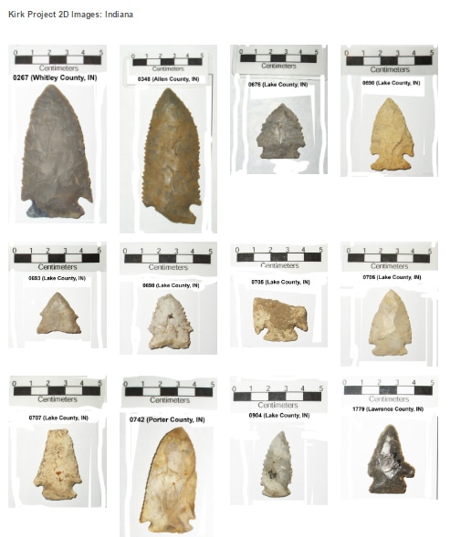
Morphometric Analysis on Two Tracks

Although based ultimately on 3D models, the analysis in the South Carolina Antiquities paper was done in 2D. I will continue working with the 3D models I'm producing, finding ways to capitalize on the richness of those data. At the same time, however, I plan to pursue a large scale 2D analysis that will allow me to make use of the large amount of data that I collected for my dissertation.  I've begun organizing and posting the "rough" scaled images of Kirk points from my Midcontinental data set by state here. It will take me a while to get all those photos in order, as there are over 600.

Once the images are assembled, I will be able to extract and analyze comparable 2D shape data from all the Kirk points in my dataset. At that point, we can finally start addressing questions about patterns of Kirk variability across large expanses of space. With a system in place, it will be much easier to feed new points from other regions into the analysis. That brings me to my next update . . .

Picture
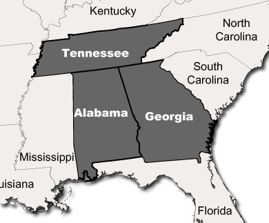
Apologies for My Sluggishness, Alabama . . . and Tennessee . . . and Georgia . . .

As I wrote several weeks ago, a mention of the Kirk Project in the newsletter of the Alabama Archaeological Society spurred several people to contact me about their collections. I have continued to get emails, but I haven't yet started assembling them in an attempt to take advantage of the offers for help and information. Starting to get back to people is next on my "to do" list today. I truly appreciate the communication, and I apologize for not responding to everyone in a more timely manner. The  "zero inbox" grail has always eluded me. It's a personal failing.

Picture
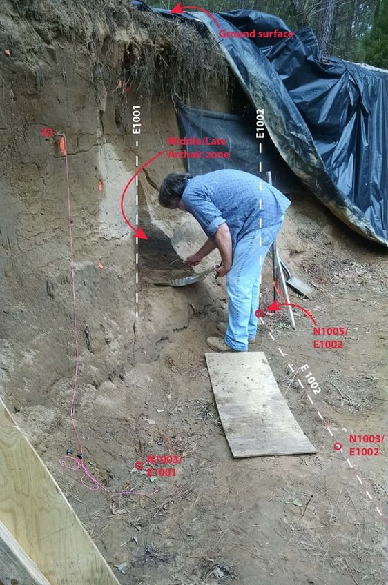
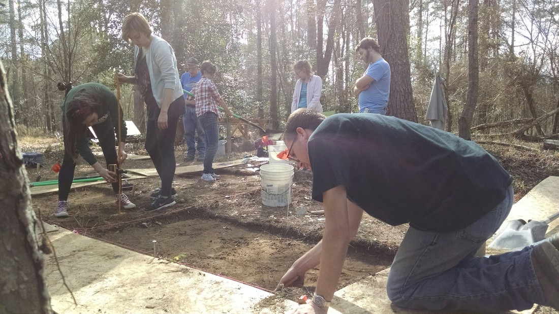
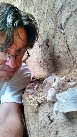
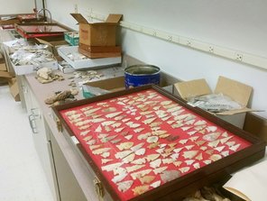
Processing a Large Collection from Aiken County, South Carolina

Over the holiday break, SCIAA received a large, donated artifact collection from Aiken County, South Carolina. Processing the entire collection (which has taken over much of my lab) is a long term proposition. One of our highest priorities is inventorying and labeling the Paleoindian and Early Archaic materials so that we (by "we" I mean primarily Al Goodyear, Joe Wilkinson, and myself) can include them in analyses. Look for those materials to be incorporated into the Kirk Project in the future.


Broad River Archaeological Field School: Day 8 (3/3/2017)

3/4/2017

 
It is March, and we have entered pine pollen season here in the South Carolina midlands. For the next few weeks, everything will be dusted yellow. 

In more exciting news, at site 38FA608 on the Broad River we have entered what appears to be an intact Late Archaic/Early Woodland midden in our excavation block.  If my initial diagnosis is correct, we're now (literally) scraping the top of a buried occupation zone that dates to around 1000 BC (i.e., about 3000 radiocarbon years before present, give or take). We've encountered this zone at about 95-100 cm below datum, which translates to roughly 65-70 cm below surface in the block. There is no sign of a heavy occupation zone in the existing vertical profile wall at that depth, so we may be dealing with something that is fairly limited in size (or at least was not distributed evenly across the ground surface that was present 3000 years ago). In that regard, this was a bit of a surprise, but it's the good kind of surprise: we're learning more about the kinds, dates, and extents of deposits at this site with every shovel-full of dirt.

​First, the "downstairs." We were without Jim Legg, so work was paused on the profile wall excavation (Unit 9). Two students finished up level 4 of Unit 7, the 1m x 2m unit being excavated to explore below the exposed profile. As I wrote last week, Unit 7 succeeded in locating the termination (or at least a hiatus in) the lamellae that presumably formed as a result of a process of particle migration/accumulation caused by water percolation. In other words, the end of the lamellae may be telling us something about the position of the water table. 
Picture
Unit 7 excavated to the base of level 4.
I'm not done with Unit 7 (I want to take it as far down as I can, as long as things are safe), but I needed to shift people up to the block to finally start excavating Unit 3. Unit 3 is the northeastern 2m x 2m unit in the block.  It has so far remained untouched. As the other units in the block get deeper, they are getting more difficult to enter and exit safely (and without putting stress on the walls). So we began excavating the eastern half of Unit 3 to serve as a step down in the other units. Now that we know the top two zones are plowzones, we can excavate them as natural levels. So it was a return to battling roots for DuVal and a couple of lucky students.
Picture
Work in progress in the block. Units 4 an 6 (right side of photo) are in level 8 (90-100 cm below datum). Unit 5 (front left) is into "good" deposits below zone 2, continuing the shovel-skimming piece-plot methodology. The east half of Unit 3 (back left) is being excavated to make a step.
Things got interesting in the block fairly quickly. Mid-morning, the students working in Unit 6 (shovel scraping through the last bits of their level 7, 75-90 cmbd) exposed a projectile point in the floor of the level. Their instructions for this level were to shovel scrape/skim at moderate speed, watching for stains and color changes and inspecting artifacts they encountered but only marking things for piece-plotting if they were large and/or interesting (i.e., diagnostic artifacts). I'm really happy that the student caught the point in the floor and it was left in place, as it gives us our first lithic diagnostic down in context in the block.
Picture
I think it's a Late Archaic / Early Woodland stemmed form, what we might call "Gary" in the Midcontinent but what is commonly known as "Mack" here. At first glance, the point has the basal shape of a Morrow Mountain (a Middle Archaic form), but I think it's much too high in the deposits to be that old. There is some unfortunate morphological overlap between Early Woodland and Middle Archaic point forms here. I'm going to be exceedingly lazy and just paste in a few paragraphs from Daniel Elliot and Ken Sassaman's (1995) Archaic Period Archaeology of the Georgia Coastal Plain and Coastal Zone (pages 44 and 45): 
Picture
Picture
The Early Woodland period is not something that I've studied extensively, but that may have to change. I was first made aware the issue of morphological overlap between stemmed points from the Middle Archaic and Early Woodland periods (leading to problems identifying points that are not from secure archaeological contexts -- i.e., the vast majority of points) at a party last year, talking to a someone with far more experience in this region than me. I filed her observation away to think about later. I guess now is later.  

Anyway, our work at this site could potentially end up being useful in helping to understand what's going on during the Early Woodland here, both in terms of lithic technology and cultural/social behavior. The zone that we're getting into in the block (partway through Zone 3) probably corresponds to the large pit features exposed in the profile wall. If we don't find any features in the block at this depth, it is only going to increase my desire to rescue what is left of those features from the profile. That would entail excavating a roughly 3m x 3m unit down from the top of deposits -- not a trivial undertaking. It would give us three more meters of vertical profile and would expose the remainder of the features in plan view. It would be a big time/energy commitment, and I don't think I can get it done during the field school. I may change my mind, however. 
Picture
My profile of the irregular machine cut, showing features originating in Zone 3. If my diagnosis is correct, those features probably date to the Late Archaic / Early Woodland.
After documenting the base of level 7 (at 90 cmbd), the students in Units 4 and 6 moved into the excavation of level 8. At the base of level 7 in Unit 6, the sediment appeared to be darker in the southeast corner of the unit. The boundary was too diffuse to define it as a feature, though, so I had the students map and describe it as a separate sediment zone. Scraping the floor at the beginning of level 8 immediately produced a good amount of material in that corner, including another point with a contracting stem. In Unit 6, they started encountering some large pieces of fire-cracked rock and lots of flaking debris. At first I thought we were might be coming down on a couple of features (one in each unit). After investigating further, however, it appeared more likely that we were just hitting the irregular top of a continuous zone that probably extends across the entire block. It was time to put on the brakes and return to a slower, more intensive piece-plotting strategy. Given that all the students have now experienced the joys of piece-plotting by hand, I'll probably fire up the total station next time we're out and begin using it to collect piece-plot coordinates electronically. 

Excavations in Unit 5 are a currently about 20 cm behind those in Units 4 and 6. Given what we now know is on the horizon for Unit 5, my plan is to continue the intensive piece-plotting excavations in that unit all the way down. At 75 cmbd, there's a possible feature to deal with (it looks fairly similar to Feature 6, the small charcoal-flecked basin we excavated in Unit 6 last week). The large, plow-sheared rock in Unit 5 remains in the floor, as we still haven't reached the surface that it's sitting on (thankfully, no-one has tripped over it yet). It will be interesting to see what, if anything, is around it when we reach the depth that would have been the surface when it was deposited.
Picture
Excavations in progress in the block. It's starting to get a little crowded in there with everything and everyone going at once.
Finally, we encountered our third serpent of this field school: a tiny snake that was sleeping under one of our plywood edge protectors. I moved it to a safe spot.
Picture

Broad River Archaeological Field School: Day 7 (2/24/2017)

3/1/2017

 
Last Friday marked the halfway point of the field school. We have accomplished a lot in seven days of work, and it's a pleasure to watch the students continue to become more and more comfortable and competent with the strategies, methods, and techniques of basic archaeological excavation.

In the "upstairs" portion of the site, excavations in Units 4 and 6 continued into the deposits beneath Zone 2. In Unit 6, we dealt with a small feature (designated Feature 6) that appeared beneath Zone 2.

A cultural "feature" is basically an immovable artifact -- an "in place" deposit created by human activity. In this part of the world, cultural features include the remains of such things as hearths, storage pits, cooking pits, postholes, burials, etc. Because intact features contain a record of a discrete set of human activities that occurred over a relatively short span of time, they hold valuable clues about what people were actually doing at a site. We love features because they give us specific information that other kinds of deposits cannot.
Picture
Feature 6 in plan view prior to excavation, with lines scribed for mapping. The inner zone of the feature consisted of a circular/elliptical stain that contained a moderate density of charcoal. The outer zone was probably a "bleed" area created by natural processes (worms, insects, and roots) mixing parts of the feature with the surrounding sediment. The nails and string mark the line along which the feature will be excavated and profiled.
As you can see from the photo above, Feature 6 was a rather unspectacular stained area that contained a moderate amount of charcoal. We used standard feature excavating techniques to document and remove the feature: (1) mapped and described it in plan view; (2) bisected it to expose a profile, screening the sediment through 1/4" mesh; (3) documented the profile; (4) removed the remaining portion of the feature as a flotation sample. There wasn't much cultural material in the feature, but there were lots of large chunks of charcoal. In profile the feature appeared to be a shallow basin with a fairly regular shape, and there was no evidence that it was a root stain or rodent burrow.
Picture
Students excavating and documenting Feature 6.
The excavation to expose Feature 6 in profile went down to about 90 cmbd (centimeters below datum), so that seemed like a good target for the bottom of level 7 in Units 4 and 6. By the end of the day, Unit 6 was well on the way to being there, with no sign of cultural features. We're using a shovel-scraping methodology that, hopefully, strikes a good balance between speed and control. I want to go slow enough to recognize cultural features if they're present, but fast enough to end up with some good data on what we're dealing with as far as the horizontal and vertical distribution of prehistoric materials.
Picture
Work in progress in the block.
Meanwhile, Unit 5 -- the third 2m x 2m unit in the "upstairs" block -- finally got to the base of Zone 2. If there was any remaining doubt that Zone 2 was plowed, those doubts were removed by a large stone exposed at the interface of Zones 2 and 3 in Unit 5.  This rock -- the biggest one I've seen at the site so far -- was undoubtedly brought to the site by prehistoric peoples. While the rock is resting securely in situ in Zone 3 sediments, its top has been sheared off and scraped multiple times by a plow (individual plow scars are visible). If there was ever "smoking gun" evidence of plowing, this is it.
Picture
Large rock at the interface of Zones 2 and 3 in Unit 5. The rock is in situ, and the top has been scraped by plowing.
Meanwhile, in the "downstairs" portion of the site, work resumed on the excavation of Unit 9 (the 1m x 3m unit placed to extend the profile wall. As excavations near the top of the (supposed) Middle/Late Archaic zone, Jim Legg dazzled the students with yet another paisley shirt. Work also continued in Unit 7, a 1m x 2m unit being excavated to explore what lies beneath the exposed profile.
Picture
Work in progress in Unit 9 (left) and Unit 7 (lower right).
The last level of Unit 7 contained very little material. It did reveal, however, that the lamellae (the dark bands of sediment caused by the downward migration and accumulation of clay particles) appear to end rather suddenly. The base sediment remains coarse sand. It's possible that the abrupt ending of the lamellae is telling us something about the level of the water table: saturated sediment would presumably not facilitate the downward migration of clay particles. This will be something we can investigate with sediment analysis once we've got a nice profile exposed that we can sample. In the meantime, I've got my fingers crossed that we don't get a significant rainfall that presses the pause button on Unit 7.

Four for Friday

2/10/2017

 
I have four quick updates to pass on today: two about archaeology and two about art.

Latest Issue of Legacy
Picture
The latest issue of Legacy (December 2016) is now available online on the SCIAA website. Published by SCIAA twice a year, Legacy features short articles relevant to South Carolina archaeology. I wrote a short piece about the research value of large surface collections, focusing on how my work with the Larry Strong collection (from Allendale County, South Carolina) is connected to the Kirk Project.

Alabama Kirk Points
Picture
I received a two emails this week about Kirk points from Alabama. Coincidence? No! There was a short mention of the Kirk Project in the latest issue of the newsletter of the Alabama Archaeological Society. I didn't know about it in advance, but I'm grateful for the exposure. I'll have an article about variability in Kirk points from Allendale County, South Carolina (see above) in the next issue of South Carolina Antiquities. As I continue to collect data from the Southeast, I plan to develop two "tracks" so I can utilize both 2D and 3D data (including all the data from my dissertation). Hopefully I'll have time to start incorporating more data from the Southeast (outside of South Carolina) as the semester moves along. Thank you, Alabama!

Upcoming Appearance on Palmetto Scene
Picture
I'll be the subject of a short piece on Palmetto Scene that is scheduled to air on February 16th at 7:30 pm. The SCETV crew came by my workshop as I was working on Owl #1. I'm nervous to see myself on TV, as I will surely feel that I look and sound like an idiot. 

Photo of Rooster -- I Mean "Gamecock" -- Sculpture in USC Today
Picture
USC Today is a daily online publication of the University of South Carolina. They did a story on my welding art back in July of 2016 and recently sent a photographer over to take a few more pictures. The action shots turned out great (I'm using one at the top of of my Sculpture page). The photographer also took some photos of things I've made since the earlier story, including my rooster sculpture.

I'm learning that talking about "roosters" around here is basically a non-starter: they're "gamecocks," plain and simple. I find myself resistant to that, as my understanding is that "gamecock" refers specifically to roosters with "physical and behavioral traits suitable for cockfighting." What if my rooster is gentle and not prone to rooster-on-rooster violence? I'm not sure I'm likely to ever win that argument in this town.

I'm working on another rooster sculpture right now. It will probably a be a couple more weeks until it's done. If you like gamecocks -- actual gamecocks -- you're going to want to see it.

Broad River Archaeological Field School: Day 4 (2/3/2017)

2/4/2017

 
If I was subtitling these posts, I'd call this one "A Tale of Two Plowzones?"

One of the main things we learned last week is that the upper sediment zone at the site is, indeed, a plowzone. Clear plow scars were present at the interface of zones 1 and 2 at the base of zone 1 in Unit 9 (the 1m x 3m unit being excavated to create a straight profile wall). In Unit 9, the plowzone was about 28 cm thick. 

With information from Unit 9 in hand, I hoped we'd be able to easily identify the same light-to-dark interface marking the base of the plowzone in the block units. Level 2 in Units 4 an 6 was targted to end at 50 cm below datum (cmbd), still within the upper zone. For level 3 in both of those units, we were able to easily discern the darker sediments immediately beneath the plowzone and excavate level 3 as a natural level, using trowels and shovels to remove the lighter plowzone sediment. I had the students in Units 4 and 6 finish off level 3 within the transition so that we could see the plow scars. Then they used trowels to remove the remaining light pockets of plowzone as level 4.
Picture
Cleaning up at the base of plowzone in Units 4 (right) and 6 (left front). Shovel excavation of Unit 5 (left rear) in progress.
In Unit 5, level 2 will proceed to the base of plowzone rather than stop at 50 cmbd. It was almost complete by the end of the day. We'll be able to get into the sub-plowzone deposits in all three units on our next day in the field.

​While the presence of a plowzone is clear, the status of the zone beneath the plowzone is not. When I first began working on the machine-exposed profile, I thought the buried dark zone (zone 2) was a buried plowzone. As I worked on the profile more, however, I began to think it was actually, perhaps, a remnant of intact prehistoric deposit. That was still my guess as of last week. We've now gotten a new, closer look at the zone in the straight profile being produced by the excavation of Unit 9, however, and I'm back to thinking it's more likely it might be a buried plowzone. The main detail affecting my thinking is the very crisp interface between the base of zone 2 and the sediment beneath it.
Picture
So far, we have no evidence of any intact cultural features in zone 2. As of now, my plan is to excavate through this zone in the block units by shovel skimming. That will give us the opportunity to keep our eyes open for cultural features originating within or immediately beneath zone 2, and will also allow us to piece-plot artifacts that are encountered if it makes sense to do so. Shovel skimming and piece-plotting will be new methods for the students, so they'll learn something by doing it even if it turns out that zone 2 actually is a buried plowzone rather than an intact cultural zone.

Jim Legg's fantastic adventure continues in the "downstairs" portion of the site as the excavation of Unit 9 plumbs the profile wall. After excavating the plowzone as a natural level, Jim and his students have begun excavating the remainder of the unit in 20 cm levels. They're now below zone 2, so they're into sediments that unquestionably contain intact prehistoric deposits.  I've got my fingers crossed that they'll hit a feature or two as Unit 9 is excavated, as a couple of absolute dates would be of great help in understanding the deposits. If there's a big feature in there, however, it could really slow down the production of the profile wall. We'll see.
Picture
Excavations in progress in Unit 9. Block excavation area visible in background.

Broad River Archaeological Field School: Day 2 (1/20/2017)

1/21/2017

 
After getting our excavation areas cleared and our units set up on Day 1, we were in good shape to start excavating first thing on Friday morning. I gave the students a brief tour of the unit excavation forms we'll be using and explained how redundancies in the information recorded on their forms, in the field specimen (FS) log, on the bags, and in their notes help catch paperwork/provenience errors early in the process. Each student was issued two Sharpies with the challenge of keeping track of them for the duration of the field school.  The first one is free, but replacement Sharpies cost $100/each.

Most of the students worked with me and DuVal Lawrence in the "upstairs" part of the site, excavating the first levels of the units in the 4m x 4m block. Jim Legg and one student worked "downstairs," beginning excavations with the goal of creating a 5m profile wall along the 1000E line. Here is the updated unit map showing the placement of Unit 8 in the "downstairs" portion of the site:
Picture
Unit 8 is a 1m x 2m unit, the east side of which is on the floor of the "downstairs" and the northwest corner of which cuts into the existing vertical wall. Legg established the unit outlines using the two permanent datums that I put in downstairs (designated by the circled x's in the map above). He excavated through the deposits in 20 cm levels, screening the sediments that were removed. The darker zone associated with the presumed Middle/Late Archaic component is clearly visible in the freshly-excavated wall.
Picture
Excavation of Unit 8 in progress (photograph taken facing grid north).
As you can see in the photograph of the Unit 8 excavation, the profile is capped by a sediment zone that contains abundant roots. That zone provided the students with their first "shovels in the ground" excavation experience as we began excavation of three of the units (Units 4, 5, and 6) in the 4m x 4m block that we laid out on Day 1.

I split the students into three groups and gave each group the task of excavating the southeastern 1m x 1m quadrant of their 2m x 2m unit. We went over the basic procedures of getting paperwork set up, labeling bags, double checking coordinates, and taking beginning depths. For the block excavation, we're controlling elevation using a rotating laser level sitting on a concrete block of known elevation (designated Datum 2017A).  Level 1 of Units 4, 5, and 6, will end at 40 cm below datum. I chose that depth to produce a level surface across the block that is still within the upper zone at the site -- these were the first ever levels excavated by these students and it's important to give them some experience with basic unit/level excavation techniques before we get into the intact deposits that (I think) will begin pretty close to the surface.
Picture
First levels in progress in the 4m x 4m block. I anticipate that the greatest technical challenge of this project will be keeping the profile walls intact as the units get deeper. We've laid down plywood on the edge to start providing support, and we'll need to set some guidelines for foot traffic and entry/exit points.
As of now, my plan is to concentrate our efforts on Units 4, 5, and 6 for the time being. With two sides exposed in profile, Unit 3 could then be excavated by natural/cultural sediment zone rather than in arbitrary levels, and could also serve as a "step" to get down into the other units. This would let us avoid putting stress on the southern and eastern sides of the block, preserving those walls for profiling.

In terms of artifacts, the first levels in block yielded low quantities of historic-period debris (a shotgun shell, a couple of pieces of iron, etc.). The first level of the NW 1/4 of Unit 4 did produce a prehistoric body sherd, however, which was a bit of a surprise. Based on the profile revealed in the vertical cut, I didn't expect to encounter prehistoric material until we penetrated what appeared to be a recently-deposited "cap" of lighter-colored sediment. I really don't understand the upper zones of the site yet, so these first levels will be interesting. It's possible that there's a well-preserved Mississippian or Woodland component near the surface, and it's also possible that material from deeper has been brought closer to the surface through natural mechanisms (animal burrows, tree falls, etc.). I hope to be at least starting level 2 in the block units by the end of next Friday. 
Picture
A very poor photograph I snapped of a prehistoric body sherd recovered from level 1 of the NW 1/4 of Unit 4.

Spring Field School: Filled and Funded

12/13/2016

 
This is just a quick update on the spring archaeological field school I announced in November. I'm happy to report two things: (1) the class has filled up; and (2) I have received notice that my request for financial support from the Archaeological Research Trust (ART) has been granted. ART grant monies will support wages for a field assistant, wages for a lab worker to keep up with processing artifacts, samples, and paperwork as we produce it in the field, and  purchase of expendable field supplies and materials to stabilize the site.  Thank you, ART members and board: you won't be disappointed!

I'll write more about the field school as it moves forward. I'm considering including a small online writing requirement in the syllabus, as communicating with the public about archaeology is important both for the education of the students and for our discipline as a whole. I'll keep you posted. In the mean time, enjoy this picture of the Broad River on a crisp fall day (taken last week during a visit to the site).
Picture

Announcement: Spring 2017 One-Day-Per-Week Archaeological Field School

11/14/2016

 
Picture
I'll be teaching a one-day-per week archaeological field school in the Spring semester. It's ANTH 322 (722 for graduate students) if you're interested. The site looks to be a really good one (I've written about it briefly before here, here, and here). I hope to kill three birds with one stone: research, teaching, and site preservation.

The site is along the Broad River north of Columbia. Weather permitting, we'll be out at the site each Friday during the spring 2017 semester. We will depart from campus each Friday at 8:00 and return by 4:00 (transportation provided). Students will bring their own lunch. There are no formal bathroom facilities on site. Each student will be required to have a small set of personal field gear (e.g., small toolbox, gloves, mason’s trowel, 5m metric tape measure, notebook, etc.). Other tools and field equipment will be provided.

This course will give you hands-on experience in basic excavation methods, techniques, and field skills, including:
  • grid systems and mapping;
  • controlled hand excavation;
  • documentation of cultural features;
  • description of sediments;
  • record keeping and photography;
  • strategy, logistics, and teamwork.
What has been learned about the site so far has come through some very preliminary fieldwork.  In the fall of 2015, archaeological materials were discovered eroding out of a 2.4 m (~8’) high, 10 m (~33’) long vertical exposure that had been created by the removal of fill dirt from a small portion of a natural levee. Cleaning and documentation of the profile revealed stratified, well-preserved cultural deposits including ceramic-bearing strata near the surface, pit features at various depths, and a horizontal zone of quartz chipping debris buried about 2 m (6.5’) beneath the surface. Artifacts show that the levee was used as a camp site over a span of at least 5000 years.
Picture
A simplified profile of deposits exposed in the vertical cut.
At least some of the chipping debris (shown as Feature 1 in the profile drawing) can be fitted back together, suggesting that the deposit was created when prehistoric peoples sat at that spot to make stone tools.  The deposit is thought to be Middle Archaic in age (dating to perhaps 4000-3000 BC) because of a quartz Guilford point that was recovered from the slump at the base of the profile. 
Picture
Portion of in-situ deposit of quartz chipping debris (Feature 1) exposed in plan during straightening of the profile wall.
The goals of the excavations will be to: (1) continue straightening, documenting, and stabilizing the exposed vertical wall; (2) collect controlled samples of artifacts that can be used to understand the 5000-year-long occupational sequence of the levee; and (2) expose discrete cultural deposits so that they can be mapped and excavated.
 
Hand excavation will be used to straighten and plumb the vertical cut, exposing a long profile that will be documented during the field school. Dr. Christopher Moore (SCIAA) will assist in interpreting the exposed natural and cultural deposits. After exposure, straightened sections of the wall will be protected from further damage using landscape fabric and wooden buttressing.
 
Hand excavation blocks will be opened in two areas. One 3 m x 2 m excavation block will be placed on top of the levee a safe distance from the existing vertical exposure. Excavations will proceed in 10 cm levels in 1 m x 1 m units, screening all sediments and creating plan maps at the base of each level. Discrete deposits (such as hearth features, storage pits, postholes, or in situ deposits of chipping debris) will be documented and excavated.
 
A 2 m x 2 m excavation block will be opened near the base of the existing vertical exposure, enlarged as needed for safety.  The purpose of this excavation area will be to extend the profile vertically downward and explore any cultural deposits present beneath the presumed Middle Archaic zone.  

Enrollment is capped at 12.  This should be a lot of fun.  It's a great spot for a field school: it's close, it's known to contain complex and interesting archaeological deposits, and it's cared for by a very supportive landowner.

If you're a student interested in taking this course, please email me with any questions:  [email protected].

Stay tuned!

New Data on a 49 KYA Stone Tool Assemblage from Australia

11/3/2016

 
PictureLocation of Warratyi rock shelter (modified from Hamm et al. 2016).
This is a quick post to bookmark a new paper that came out in Nature yesterday describing the excavation of Warratyi rock shelter in Australia.  The paper ("Cultural Innovation and Megafauna Interaction in the Early Settlement of Arid Australia," by Giles Hamm, Peter Mitchell, Lee J. Arnold, Gavin J. Prideaux, Daniele Questiaux, Nigel A. Spooner, Vladimir A. Levchenko, Elizabeth C. Foley, Trevor H. Worthy, Birgitta Stephenson, Vincent Coulthard, Clifford Coulthard,Sophia Wilton, and Duncan Johnston) describes archaeological deposits dating back to about 49 thousand years ago (KYA). 

This one caught my attention not only because it adds important information to what we know about the colonization of Australia, but also because of the ongoing controversy about the claimed 55 KYA lithic assemblage from the Topper site in South Carolina (I wrote a little about my first impressions of Topper here).

One of the main questions about the early "artifacts" from Topper is whether or not they're actually artifacts (i.e., things made or modified by humans). In this 2005 paper (page 110) my colleague Al Goodyear describes the Topper assemblage as

"remarkable for its nonbifacial character and its emphasis on microlithic-sized artifacts, specifically bend-break burin-like tools. . . . The emphasis on microlithic tools, as well as core choppers, suggests some type of craft activity. The presence of microliths may imply the manufacture of organic artifacts from bone, antler, wood, and ivory."

Picture
Illustration of lithics from pre-Clovis deposits at the Topper site (from paper sourced in text above).
One of the criticisms leveled at the pre-Clovis assemblage from Topper is that there are no similar industries anywhere in the world that date to a similar time period. I have not yet done the work to evaluate that argument. The report of a 49 KYA site in Australia caught my eye, however, as a possible assemblage that could be compared to the one at Topper. It's certainly in the right ballpark in terms of time, and it was certainly made by terrestrial hunter-gatherers who would have required boats to get to Australia in the first place.  

So what does the lithic assemblage from the early occupations at 
Warratyi look like? It's hard to tell from the publication. This is what the authors say about the lithics:

"Stone artefacts were found throughout the deposit (Fig. 2) with concentrations at depths of 5–20 cm (corresponding to SU1–upper part SU2) and 60–80 cm (SU3). The lithic assemblage is mostly composed of whole flakes, broken flakes and waste material. Stone artefacts were made from a range of raw materials, reflecting a change in use of preferred rock-type over time. Tools in the lowermost units were predominantly made of quartz. In the upper part of SU2 and in SU1, chert and silcrete become major components. This pattern was also reflected by changes in tool types; SU1 and SU2 contained predominately backed and small hafted tools, whereas SU3 and SU4 contained whole and retouched flakes (Extended Data Fig. 5)."

Stratigraphic Units 3 and 4 (SU3 and SU4) appear to date from about 33 KYA to 49 KYA, so those are the ones of interest in terms of comparisons with Topper. Other than the description "contained whole and retouched flakes"  the paper doesn't appear to have much information of the lithic artifacts from the earliest portions of the deposits. I can't tell which (if any) of the stone artifacts shown in their figure are from SU3 and SU4.  I didn't notice a mention of bifaces or bifacial flaking debris. There is a bone point from SU3 that reportedly dates to about 40 KYA. 

So . . .  that's about all I have to say about that for now. I skimmed the article quickly, so it may be that I missed something with regard to the lithic assemblage. It would be interesting to have some additional qualitative and quantitative data about the tools and debris from those earliest deposits.

"Social Implications of Large-Scale Demographic Change During the Early Archaic Period in the Southeast"

11/1/2016

 
I've loaded a pdf version of my 2016 SEAC presentation "Social Implications of Large-Scale Demographic Change During the Early Archaic Period in the Southeast" onto my Academia.edu page (you can also access a copy here). Other than a few minor alterations to complete the citations and adjust the slides to get rid of the animations, it's what I presented at the meetings last Friday. I tend to use slides as prompts for speaking, so some of the information that I tried to convey isn't directly represented on the slides. There's enough there that you can get a pretty good idea, I hope, of what I was going for.
Picture
<<Previous
Forward>>

    All views expressed in my blog posts are my own. The views of those that comment are their own. That's how it works.

    I reserve the right to take down comments that I deem to be defamatory or harassing. 

    Andy White

    Email me: [email protected]

    Enter your email address:

    Delivered by FeedBurner


    Picture

    Sick of the woo?  Want to help keep honest and open dialogue about pseudo-archaeology on the internet? Please consider contributing to Woo War Two.
    Picture

    Follow updates on posts related to giants on the Modern Mythology of Giants page on Facebook.

    Archives

    May 2024
    January 2024
    January 2023
    January 2022
    November 2021
    September 2021
    August 2021
    March 2021
    June 2020
    April 2020
    March 2020
    January 2020
    December 2019
    November 2019
    October 2019
    September 2019
    May 2019
    April 2019
    January 2019
    December 2018
    November 2018
    October 2018
    September 2018
    August 2018
    July 2018
    June 2018
    May 2018
    April 2018
    March 2018
    February 2018
    January 2018
    December 2017
    November 2017
    October 2017
    September 2017
    August 2017
    July 2017
    June 2017
    May 2017
    April 2017
    March 2017
    February 2017
    January 2017
    December 2016
    November 2016
    October 2016
    September 2016
    August 2016
    July 2016
    June 2016
    May 2016
    April 2016
    March 2016
    February 2016
    January 2016
    December 2015
    November 2015
    October 2015
    September 2015
    August 2015
    July 2015
    June 2015
    May 2015
    April 2015
    March 2015
    February 2015
    January 2015
    December 2014
    November 2014
    September 2014
    August 2014
    June 2014
    May 2014
    April 2014
    March 2014

    Categories

    All
    3D Models
    AAA
    Adena
    Afrocentrism
    Agent Based Modeling
    Agent-based Modeling
    Aircraft
    Alabama
    Aliens
    Ancient Artifact Preservation Society
    Androgynous Fish Gods
    ANTH 227
    ANTH 291
    ANTH 322
    Anthropology History
    Anunnaki
    Appalachia
    Archaeology
    Ardipithecus
    Art
    Atlantis
    Australia
    Australopithecines
    Aviation History
    Bigfoot
    Birds
    Boas
    Book Of Mormon
    Broad River Archaeological Field School
    Bronze Age
    Caribou
    Carolina Bays
    Ceramics
    China
    Clovis
    Complexity
    Copper Culture
    Cotton Mather
    COVID-19
    Creationism
    Croatia
    Crow
    Demography
    Denisovans
    Diffusionism
    DINAA
    Dinosaurs
    Dirt Dance Floor
    Double Rows Of Teeth
    Dragonflies
    Early Archaic
    Early Woodland
    Earthworks
    Eastern Woodlands
    Eastern Woodlands Household Archaeology Data Project
    Education
    Egypt
    Europe
    Evolution
    Ewhadp
    Fake Hercules Swords
    Fetal Head Molding
    Field School
    Film
    Florida
    Forbidden Archaeology
    Forbidden History
    Four Field Anthropology
    Four-field Anthropology
    France
    Genetics
    Genus Homo
    Geology
    Geometry
    Geophysics
    Georgia
    Giants
    Giants Of Olden Times
    Gigantism
    Gigantopithecus
    Graham Hancock
    Grand Valley State
    Great Lakes
    Hollow Earth
    Homo Erectus
    Hunter Gatherers
    Hunter-gatherers
    Illinois
    India
    Indiana
    Indonesia
    Iowa
    Iraq
    Israel
    Jim Vieira
    Jobs
    Kensington Rune Stone
    Kentucky
    Kirk Project
    Late Archaic
    Lemuria
    Lithic Raw Materials
    Lithics
    Lizard Man
    Lomekwi
    Lost Continents
    Mack
    Mammoths
    Mastodons
    Maya
    Megafauna
    Megaliths
    Mesolithic
    Michigan
    Middle Archaic
    Middle Pleistocene
    Middle Woodland
    Midwest
    Minnesota
    Mississippi
    Mississippian
    Missouri
    Modeling
    Morphometric
    Mound Builder Myth
    Mu
    Music
    Nazis
    Neandertals
    Near East
    Nephilim
    Nevada
    New Mexico
    Newspapers
    New York
    North Carolina
    Oahspe
    Oak Island
    Obstetrics
    Ohio
    Ohio Valley
    Oldowan
    Olmec
    Open Data
    Paleoindian
    Paleolithic
    Pilumgate
    Pleistocene
    Pliocene
    Pre Clovis
    Pre-Clovis
    Prehistoric Families
    Pseudo Science
    Pseudo-science
    Radiocarbon
    Reality Check
    Rome
    Russia
    SAA
    Sardinia
    SCIAA
    Science
    Scientific Racism
    Sculpture
    SEAC
    Search For The Lost Giants
    Sexual Dimorphism
    Sitchin
    Social Complexity
    Social Networks
    Solutrean Hypothesis
    South Africa
    South America
    South Carolina
    Southeast
    Stone Holes
    Subsistence
    Swordgate
    Teaching
    Technology
    Teeth
    Television
    Tennessee
    Texas
    Topper
    Travel
    Travel Diaries
    Vaccines
    Washington
    Whatzit
    White Supremacists
    Wisconsin
    Woo War Two
    World War I
    World War II
    Writing
    Younger Dryas

    RSS Feed

    Picture
Proudly powered by Weebly