The Kirk Project
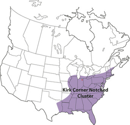 Distribution of Kirk Corner Notched cluster projectile points (adapted from Justice 1987).
The Kirk Project is an effort to assemble a large (pan-Eastern) database of projectile points assignable to the Kirk Corner Notched cluster.
The existence of a “Kirk Horizon” (dating to about 8,800-6,600 BC) extending north-south from the lower Great Lakes to the Florida Keys and east-west from the Atlantic Coast to the Mississippi Valley has been noted for over four decades (i.e., at least since James Tuck’s 1974 paper “Early Archaic Horizons in Eastern North America”). Although many authors have remarked on the striking similarity of Kirk Corner Notched projectile points from across this large area, here has never been a concerted effort to assemble a dataset of sufficient detail and spatial scope to allow us to characterize and analyze the kinds, amounts, and spatial components of variability among these points.
Assembly of a pan-Eastern Kirk dataset will be useful for addressing numerous questions about the Early Holocene hunting-gathering societies of the Eastern Woodlands. I plan to build from the dataset of Kirk points from the Midwest that I assembled as part of my dissertation work, adding information from (1) materials that I have direct access to in South Carolina and (2) data contributed by others working in the Eastern Woodlands. I will make the datasets (including derived metric data and the raw data from 3D models) available periodically as it is updated.
Interested in submitting data? Guidelines for contributing are here.
Navigation:
Blog Posts
- "An Update on the Kirk Project" (Andy White, 3/6/2017)
- "In Press: "A Preliminary Analysis of Haft Variability in South Carolina Kirk Points"" (Andy White, 11/28/2016)
- "Social Implications of Large-Scale Demographic Change During the Early Archaic Period in the Southeast" (Andy White, 11/1/2016)
- "Early Hunter-Gatherer Societies" Symposium at SEAC" (Andy White, 10/26/2016)
- "Some Very Preliminary Kirk Morphometric Data" (Andy White, 10/4/2016)
- "Kirk Project: Workflow from Point to 3D Morphometric Data" (Andy White, 5/6/2016)
- "My Thursday: Radiocarbon and Kirk" (Andy White, 5/5/2016)
- "One Procedure for Generating Linear Measurements from 3D Models" (Andy White, 4/6/2016)
- "SEAC 2016 Symposium: Hunter-Gatherer Societies of the Early Holocene Southeast" (Andy White, 4/4/2016)
- "The Kirk Project: An Update" (Andy White, 3/17/2016)
- "Kirk Project Presentation at the ASSC Meeting" (Andy White, 2/20/2016)
- "Submitting Data to the Kirk Project" (Andy White, 2/12/2016)
- "A Test 3D Model of a Kirk Corner Notched Point" (Andy White, 2/8/2016)
- "The Kirk Project: The Nipper Creek Cache" (Andy White, 2/5/2016)
- "The Kirk Project" (Andy White, 2/4/2016)
- "Early Eastern Hunter-Gatherers and Holiday Travel" (Andy White, 11/24/2016)
Current Distribution Map
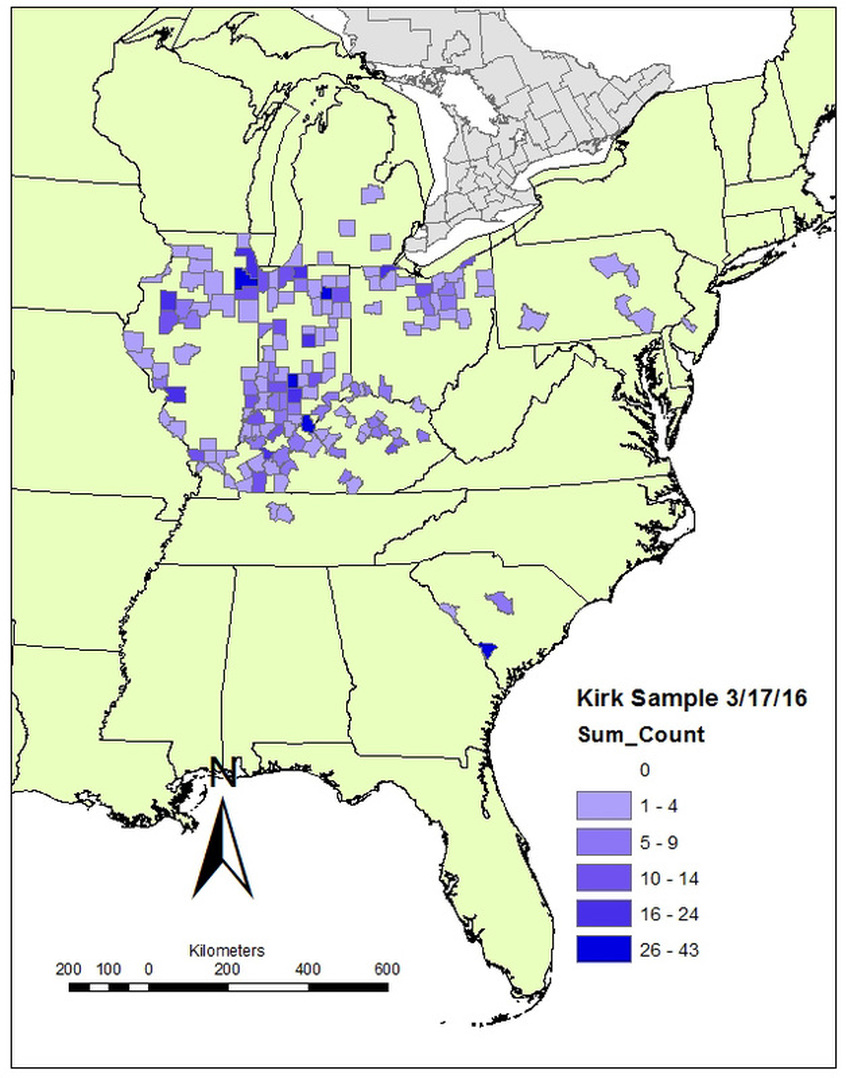
Geographic distribution of the Kirk Sample by county as of 3/17/2016.