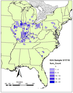
Kirk Project Sample Location (3/17/2016): This is an Excel file of the sample as of 3/17/2016 (n=905) that includes only the ID number, the county of origin, and UTM coordinates (NAD 1983, Zone 16N) of the county of origin.
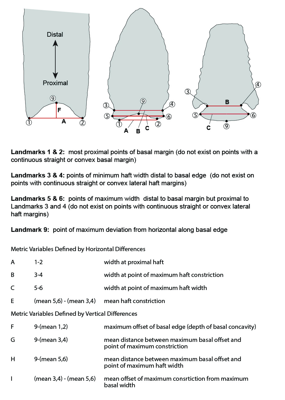
Kirk Project Metric Data (3/17/2016): This is an Excel file of the metric data associated with the sample as of 3/17/2016. This file includes the county-level provenience information of the points (n=699) as well as information about associated images, 3D models, thickness measured with calipers, and linear measurements designated A though I (those measurements are defined here). Note that the sample of points for which metric data are available is smaller than the larger Kirk sample. I did not measure all of the points in the sample during my dissertation work (some were too fragmentary) and I have not started generating linear measurements of the points I'm adding now. I did not produce 3D models of any of the points in my dissertation dataset, as I did not have access to the equipment to do that at the time.
Old Datasets
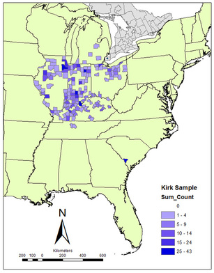
Kirk Project Sample Location (2/2/2016): This is an Excel file of the sample as of 2/2/2016 (n=889) that includes only the ID number, the county of origin, and UTM coordinates (NAD 1983, Zone 16N) of the county of origin.