It is March, and we have entered pine pollen season here in the South Carolina midlands. For the next few weeks, everything will be dusted yellow.
In more exciting news, at site 38FA608 on the Broad River we have entered what appears to be an intact Late Archaic/Early Woodland midden in our excavation block. If my initial diagnosis is correct, we're now (literally) scraping the top of a buried occupation zone that dates to around 1000 BC (i.e., about 3000 radiocarbon years before present, give or take). We've encountered this zone at about 95-100 cm below datum, which translates to roughly 65-70 cm below surface in the block. There is no sign of a heavy occupation zone in the existing vertical profile wall at that depth, so we may be dealing with something that is fairly limited in size (or at least was not distributed evenly across the ground surface that was present 3000 years ago). In that regard, this was a bit of a surprise, but it's the good kind of surprise: we're learning more about the kinds, dates, and extents of deposits at this site with every shovel-full of dirt.
First, the "downstairs." We were without Jim Legg, so work was paused on the profile wall excavation (Unit 9). Two students finished up level 4 of Unit 7, the 1m x 2m unit being excavated to explore below the exposed profile. As I wrote last week, Unit 7 succeeded in locating the termination (or at least a hiatus in) the lamellae that presumably formed as a result of a process of particle migration/accumulation caused by water percolation. In other words, the end of the lamellae may be telling us something about the position of the water table.
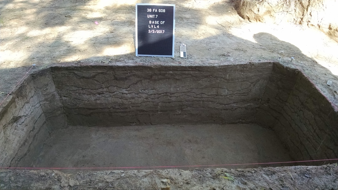
Unit 7 excavated to the base of level 4.
I'm not done with Unit 7 (I want to take it as far down as I can, as long as things are safe), but I needed to shift people up to the block to finally start excavating Unit 3. Unit 3 is the northeastern 2m x 2m unit in the block. It has so far remained untouched. As the other units in the block get deeper, they are getting more difficult to enter and exit safely (and without putting stress on the walls). So we began excavating the eastern half of Unit 3 to serve as a step down in the other units. Now that we know the top two zones are plowzones, we can excavate them as natural levels. So it was a return to battling roots for DuVal and a couple of lucky students.
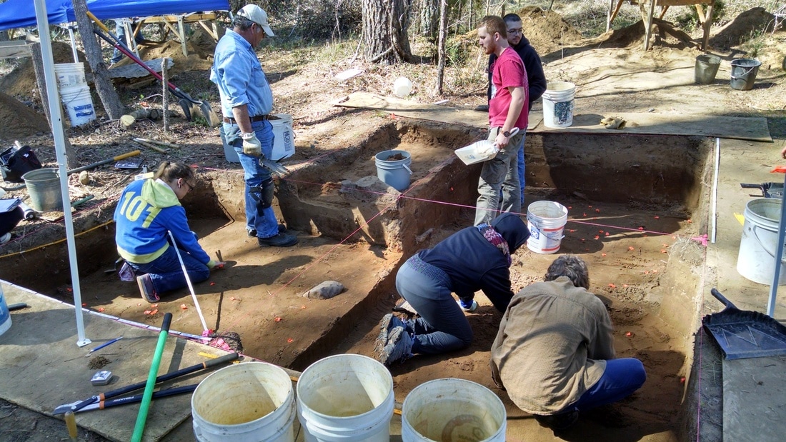
Work in progress in the block. Units 4 an 6 (right side of photo) are in level 8 (90-100 cm below datum). Unit 5 (front left) is into "good" deposits below zone 2, continuing the shovel-skimming piece-plot methodology. The east half of Unit 3 (back left) is being excavated to make a step.
Things got interesting in the block fairly quickly. Mid-morning, the students working in Unit 6 (shovel scraping through the last bits of their level 7, 75-90 cmbd) exposed a projectile point in the floor of the level. Their instructions for this level were to shovel scrape/skim at moderate speed, watching for stains and color changes and inspecting artifacts they encountered but only marking things for piece-plotting if they were large and/or interesting (i.e., diagnostic artifacts). I'm really happy that the student caught the point in the floor and it was left in place, as it gives us our first lithic diagnostic down in context in the block.
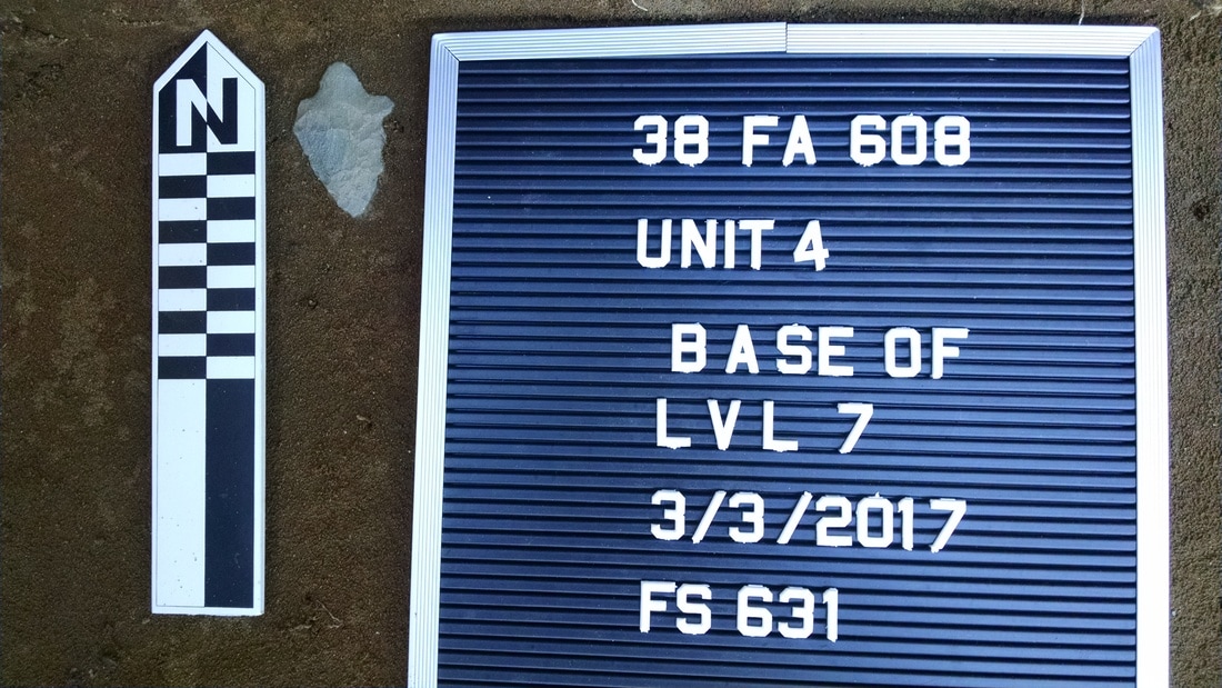
I think it's a Late Archaic / Early Woodland stemmed form, what we might call "Gary" in the Midcontinent but what is commonly known as "Mack" here. At first glance, the point has the basal shape of a Morrow Mountain (a Middle Archaic form), but I think it's much too high in the deposits to be that old. There is some unfortunate morphological overlap between Early Woodland and Middle Archaic point forms here. I'm going to be exceedingly lazy and just paste in a few paragraphs from Daniel Elliot and Ken Sassaman's (1995) Archaic Period Archaeology of the Georgia Coastal Plain and Coastal Zone (pages 44 and 45):
The Early Woodland period is not something that I've studied extensively, but that may have to change. I was first made aware the issue of morphological overlap between stemmed points from the Middle Archaic and Early Woodland periods (leading to problems identifying points that are not from secure archaeological contexts -- i.e., the vast majority of points) at a party last year, talking to a someone with far more experience in this region than me. I filed her observation away to think about later. I guess now is later.
Anyway, our work at this site could potentially end up being useful in helping to understand what's going on during the Early Woodland here, both in terms of lithic technology and cultural/social behavior. The zone that we're getting into in the block (partway through Zone 3) probably corresponds to the large pit features exposed in the profile wall. If we don't find any features in the block at this depth, it is only going to increase my desire to rescue what is left of those features from the profile. That would entail excavating a roughly 3m x 3m unit down from the top of deposits -- not a trivial undertaking. It would give us three more meters of vertical profile and would expose the remainder of the features in plan view. It would be a big time/energy commitment, and I don't think I can get it done during the field school. I may change my mind, however.
Anyway, our work at this site could potentially end up being useful in helping to understand what's going on during the Early Woodland here, both in terms of lithic technology and cultural/social behavior. The zone that we're getting into in the block (partway through Zone 3) probably corresponds to the large pit features exposed in the profile wall. If we don't find any features in the block at this depth, it is only going to increase my desire to rescue what is left of those features from the profile. That would entail excavating a roughly 3m x 3m unit down from the top of deposits -- not a trivial undertaking. It would give us three more meters of vertical profile and would expose the remainder of the features in plan view. It would be a big time/energy commitment, and I don't think I can get it done during the field school. I may change my mind, however.
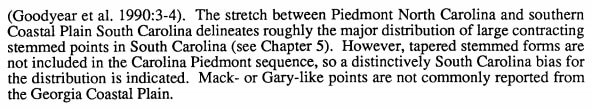
My profile of the irregular machine cut, showing features originating in Zone 3. If my diagnosis is correct, those features probably date to the Late Archaic / Early Woodland.
After documenting the base of level 7 (at 90 cmbd), the students in Units 4 and 6 moved into the excavation of level 8. At the base of level 7 in Unit 6, the sediment appeared to be darker in the southeast corner of the unit. The boundary was too diffuse to define it as a feature, though, so I had the students map and describe it as a separate sediment zone. Scraping the floor at the beginning of level 8 immediately produced a good amount of material in that corner, including another point with a contracting stem. In Unit 6, they started encountering some large pieces of fire-cracked rock and lots of flaking debris. At first I thought we were might be coming down on a couple of features (one in each unit). After investigating further, however, it appeared more likely that we were just hitting the irregular top of a continuous zone that probably extends across the entire block. It was time to put on the brakes and return to a slower, more intensive piece-plotting strategy. Given that all the students have now experienced the joys of piece-plotting by hand, I'll probably fire up the total station next time we're out and begin using it to collect piece-plot coordinates electronically.
Excavations in Unit 5 are a currently about 20 cm behind those in Units 4 and 6. Given what we now know is on the horizon for Unit 5, my plan is to continue the intensive piece-plotting excavations in that unit all the way down. At 75 cmbd, there's a possible feature to deal with (it looks fairly similar to Feature 6, the small charcoal-flecked basin we excavated in Unit 6 last week). The large, plow-sheared rock in Unit 5 remains in the floor, as we still haven't reached the surface that it's sitting on (thankfully, no-one has tripped over it yet). It will be interesting to see what, if anything, is around it when we reach the depth that would have been the surface when it was deposited.
Excavations in Unit 5 are a currently about 20 cm behind those in Units 4 and 6. Given what we now know is on the horizon for Unit 5, my plan is to continue the intensive piece-plotting excavations in that unit all the way down. At 75 cmbd, there's a possible feature to deal with (it looks fairly similar to Feature 6, the small charcoal-flecked basin we excavated in Unit 6 last week). The large, plow-sheared rock in Unit 5 remains in the floor, as we still haven't reached the surface that it's sitting on (thankfully, no-one has tripped over it yet). It will be interesting to see what, if anything, is around it when we reach the depth that would have been the surface when it was deposited.
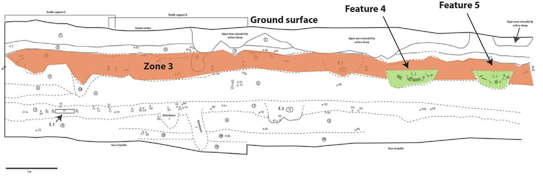
Excavations in progress in the block. It's starting to get a little crowded in there with everything and everyone going at once.
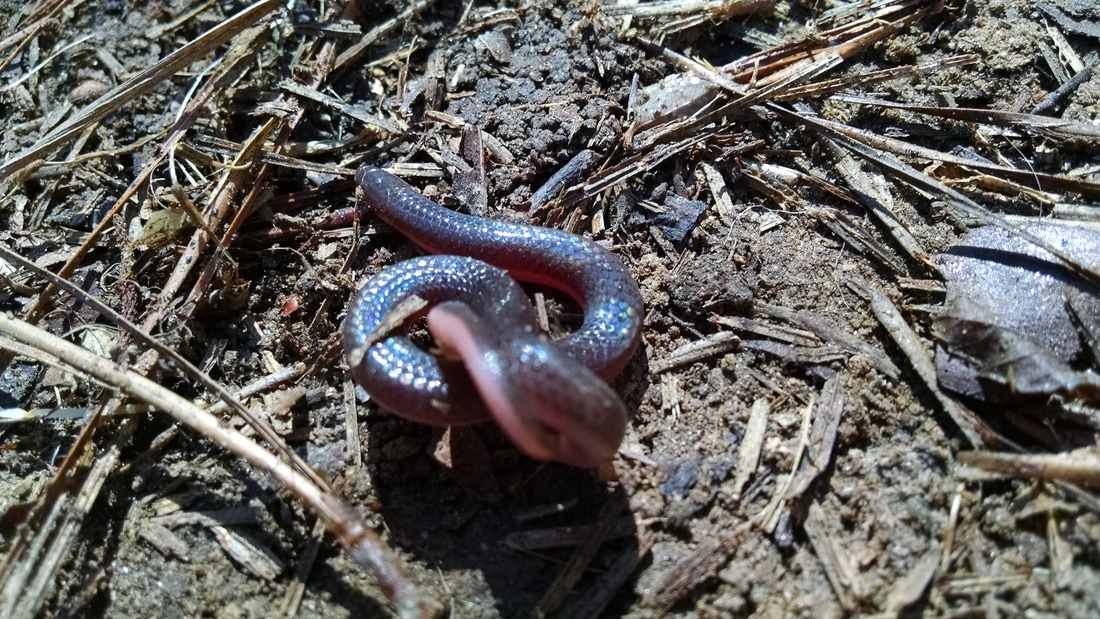
Finally, we encountered our third serpent of this field school: a tiny snake that was sleeping under one of our plywood edge protectors. I moved it to a safe spot.


 RSS Feed