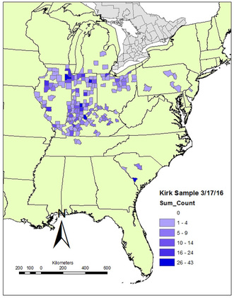
I've been steadily accumulating 3D models (there are 22 now that I've uploaded to Sketchfab). I still haven't started wrestling with them to extract usable morphometric data, but I've got a plan for a paper that will compare variability in the large, surface collected sample from Allendale County (South Carolina) to the variability present in smaller assemblages from excavated contexts (and shorter windows of time). One of those assemblages will be the Nipper Creek cache. Another (hopefully) will be the Kirk material from G. S. Lewis-East. Hopefully I'll be able to get one or two more "narrow time window" assemblages.
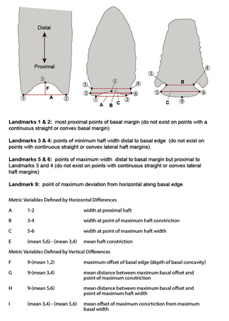
The linear measurements have alphabetic designations (A through I, as defined in this figure). I calculated them by digitizing landmarks using a freeware package, and it was kind of a pain in the butt. I'm hoping to find a better software package than I used before, and I plan on adding some additional 2D dimensions/angles since I won't also be dealing with lanceolate points.
I did not produce 3D models of any of the points in my dissertation dataset, as I did not have access to the equipment to do that at the time.
I plan on adding a "Contributors" page soon. And I hope to start incorporating more data from external sources in the dataset. I've got lines on some data from Ohio, Tennessee, and a few other areas. I would love to start filling in Florida, Georgia, and North Carolina.

 RSS Feed
