Andy White Anthropology
  • Home
  • Fake Hercules Swords
  • Research Interests
    • Complexity Science
    • Prehistoric Social Networks
    • Eastern Woodlands Prehistory
    • Ancient Giants
  • Blog

Broad River Archaeological Field School: Day 13 (4/14/2017)

4/18/2017

 
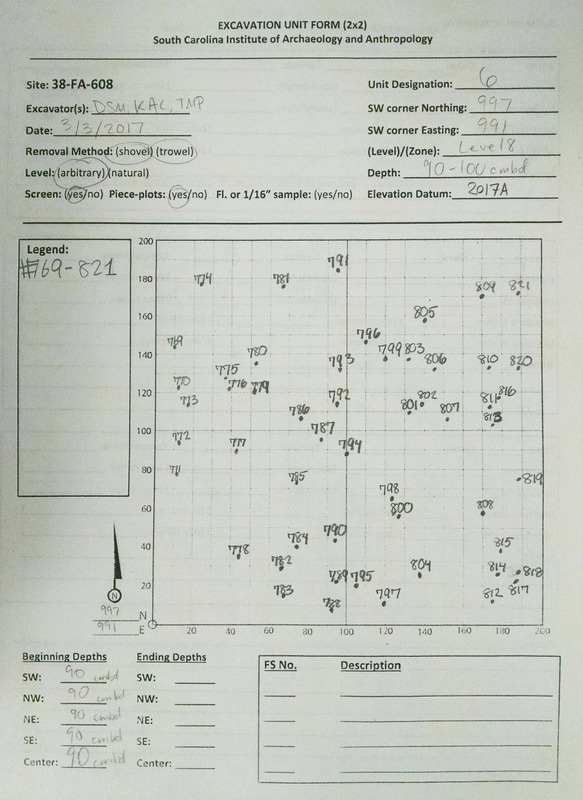
Day 13 saw us continue down the path toward wrapping up our excavations for the semester. The "upstairs" is going along willingly, the "downstairs" . . . not so much.

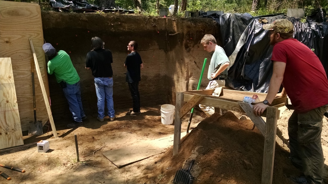
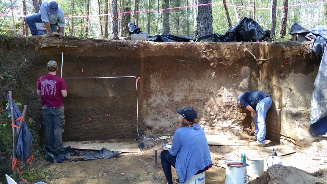
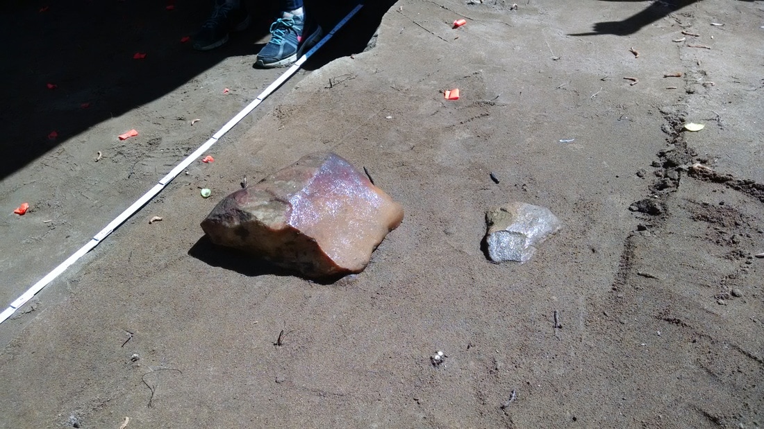
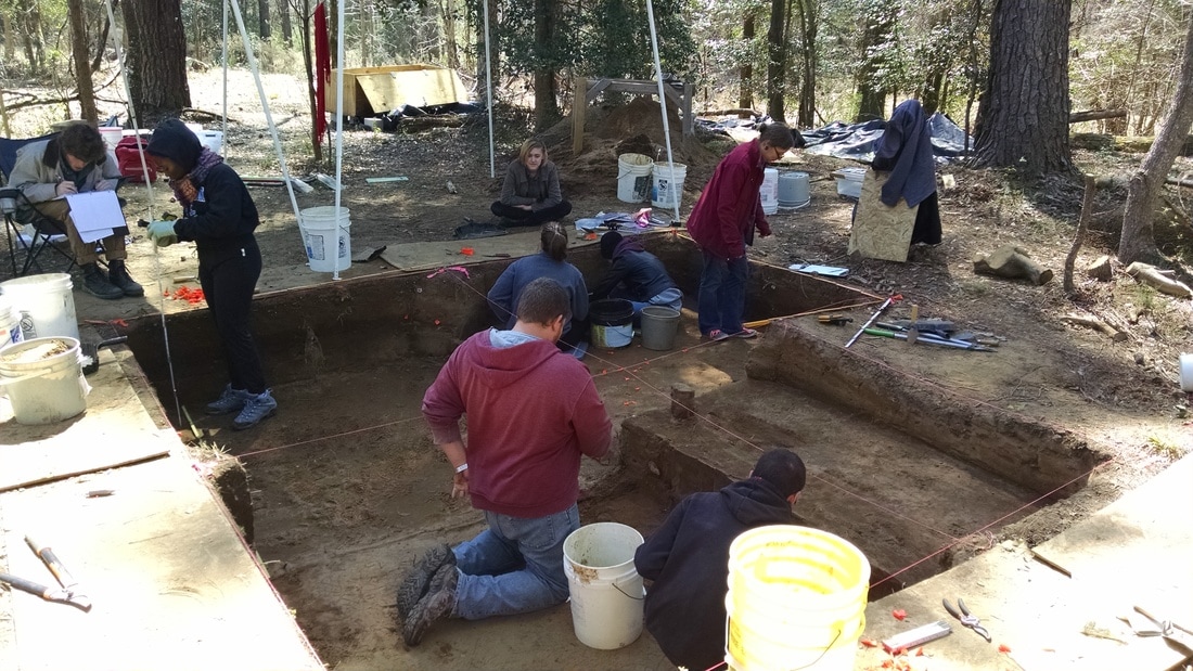
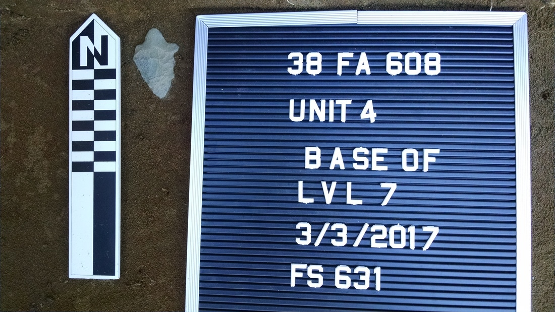
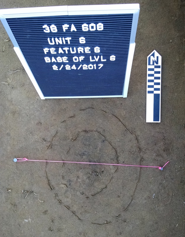
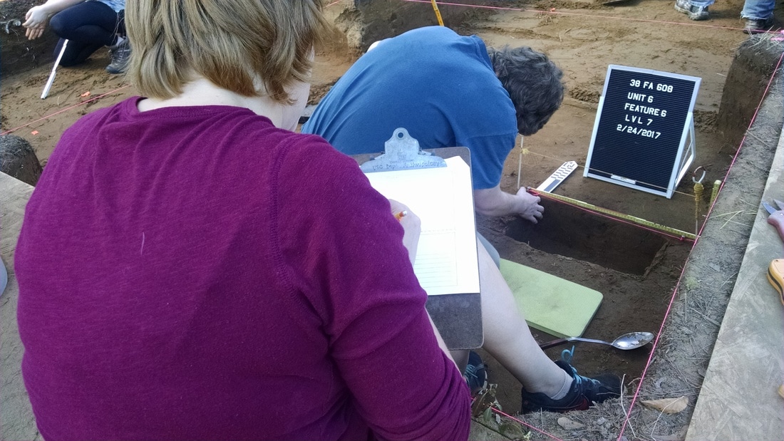
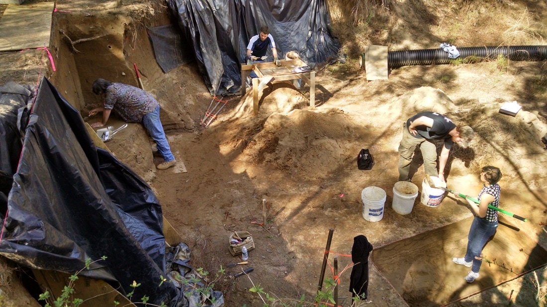
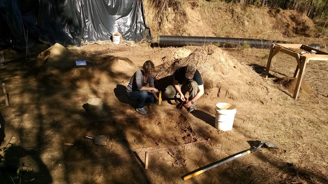
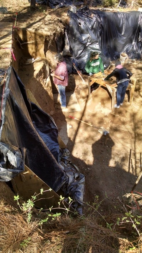
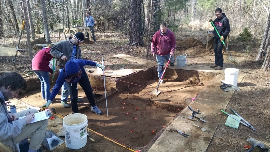
As I wrote last week, we wrapped up level excavations in Unit 4 and 6 and had just a few loose ends (final scraping and mapping of floor, etc.) in Unit 5. Today's goals were to finish the level excavations in Unit 5 and document the walls of the block by photographing and making profile drawings.  I took my own notes on the sediments in the profiles and collected a charcoal sample from one of the probable features exposed in the floor of Unit 4. The block was crowded.
Picture
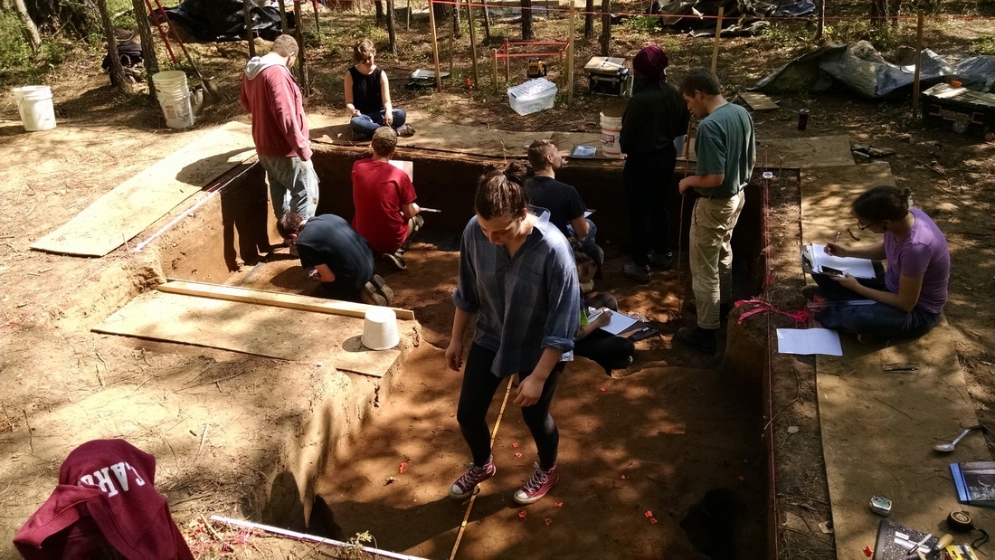
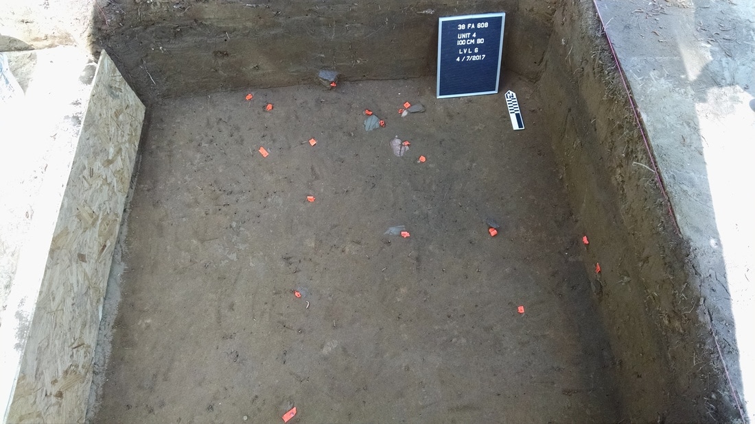
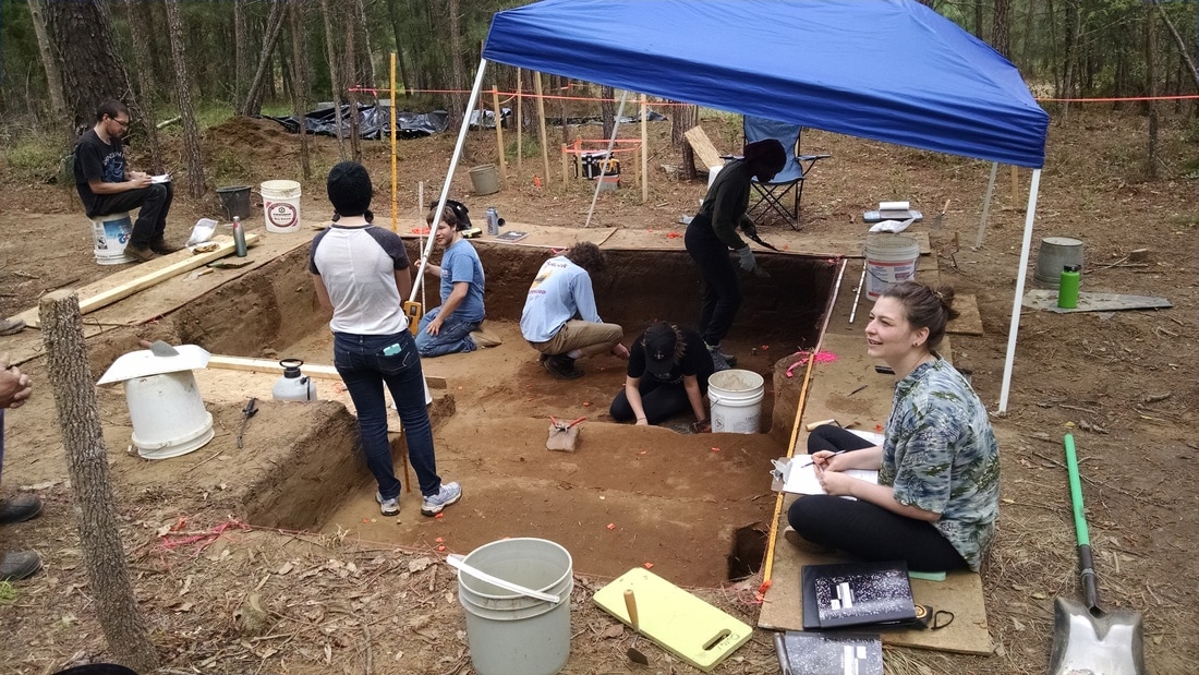
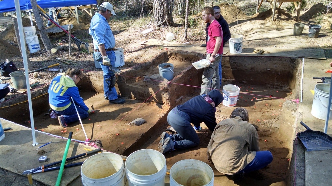
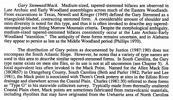
All ten students working in the block at the same time. Prior to profiling the walls, we covered with floors with landscape fabric and a thin layer of backdirt to protect the intact deposits exposed in the floor from trampling.
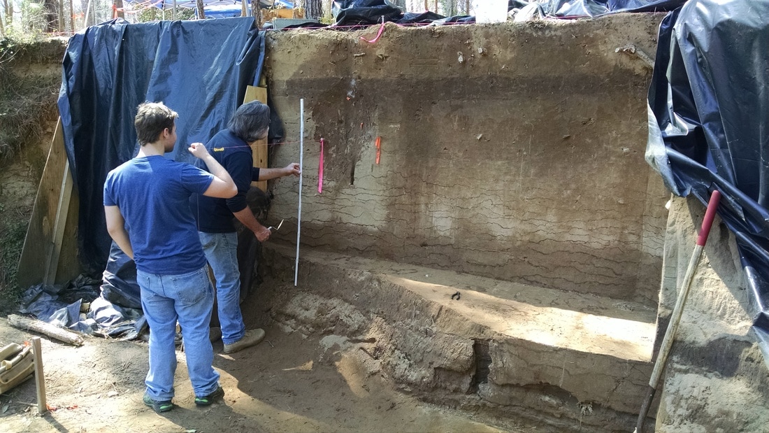
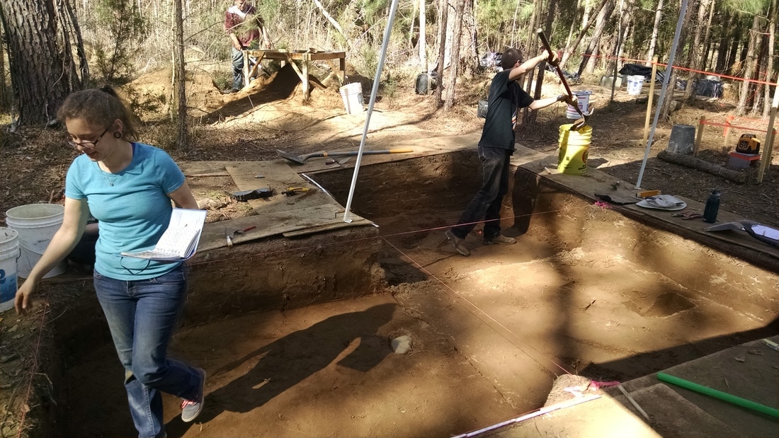
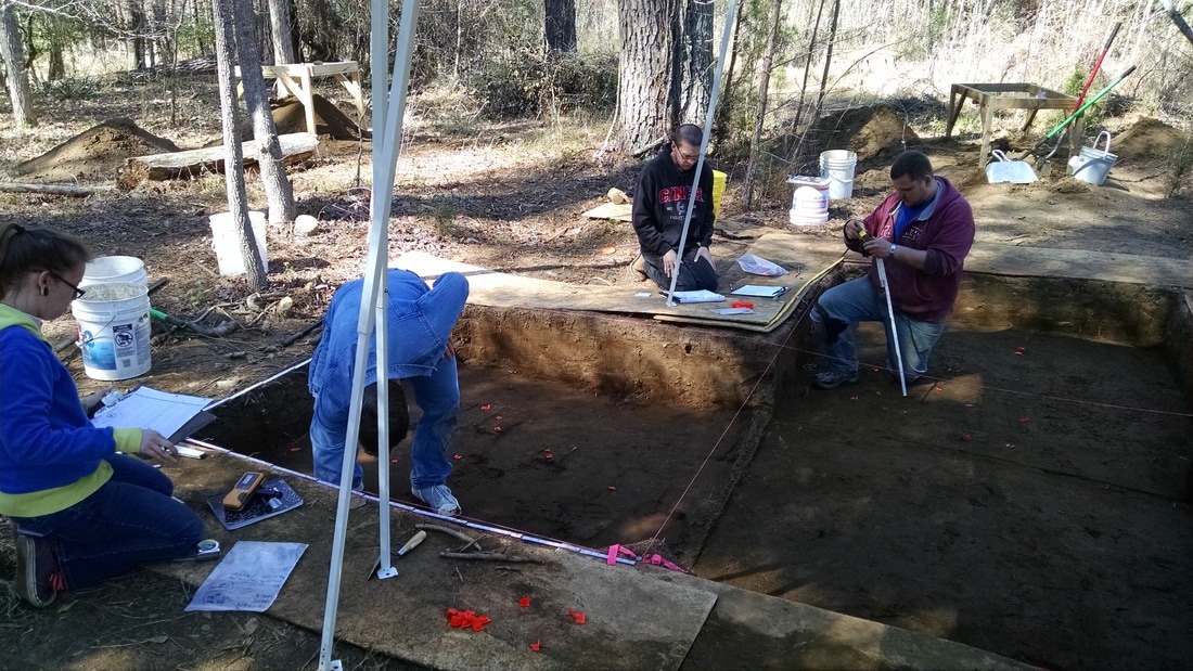
Profile drawings are key to understanding the deposits from which we removed artifacts. It is often easier to understand the stratigraphy in profile (i.e., in a vertical plane) than in plan (as you're excavating through it). This is very true at this site, where the loose sand dries out quickly and makes it more difficult to move in the unit without disturbing artifacts and obscuring variation in the exposed sediments.

Drawing a profile uses many of the same skills the students learned while piece-plotting artifacts and making horizontal maps. The big difference is that one of the dimensions is elevation. The traditional way of drawing a profile is to establish a level line along the plane that you're drawing, measuring in everything in relation to that line. Setting a level line is simply a matter of stretching a string tightly between two anchoring points (typically gutter spikes or chaining pins), using a simple mason's line level to make the string level. ​
Picture
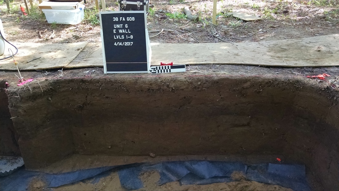
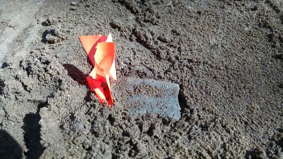
An example of a profile wall prepared for drawing. The red item over the north arrow is a line level.
By the end of the day, the students had completed all the work in the "upstairs" block and had gotten much of the backfilling done. To protect the floors and walls until I can open the excavation again, we lined everything with landscape fabric and placed pieces of chipboard along the walls. The landscape fabric provides a marker between what's been excavated and what hasn't and, unlike plastic, allows water to pass through. The purpose of the vertical wood panels is to allow us to shovel right up to the walls when the fill is removed in the future. The whole enterprise will be filled and buried.
Picture
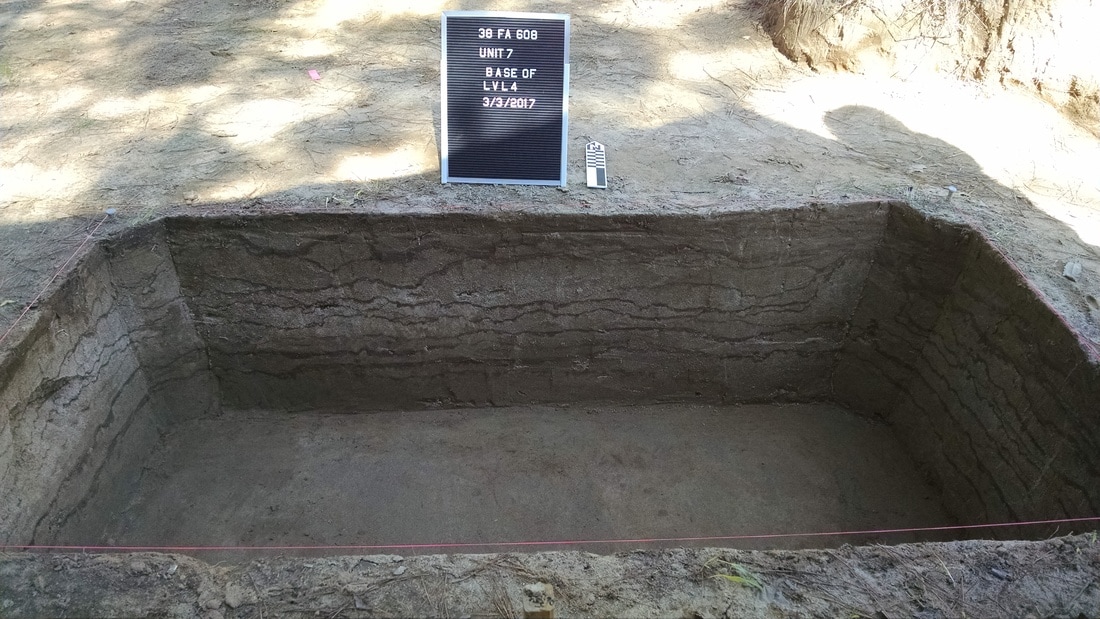
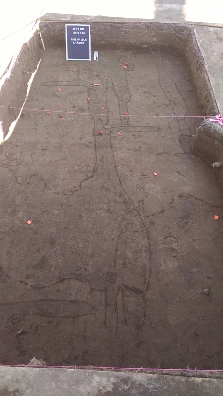
Excavation block with Units 4 and 6 prepped for backfilling.
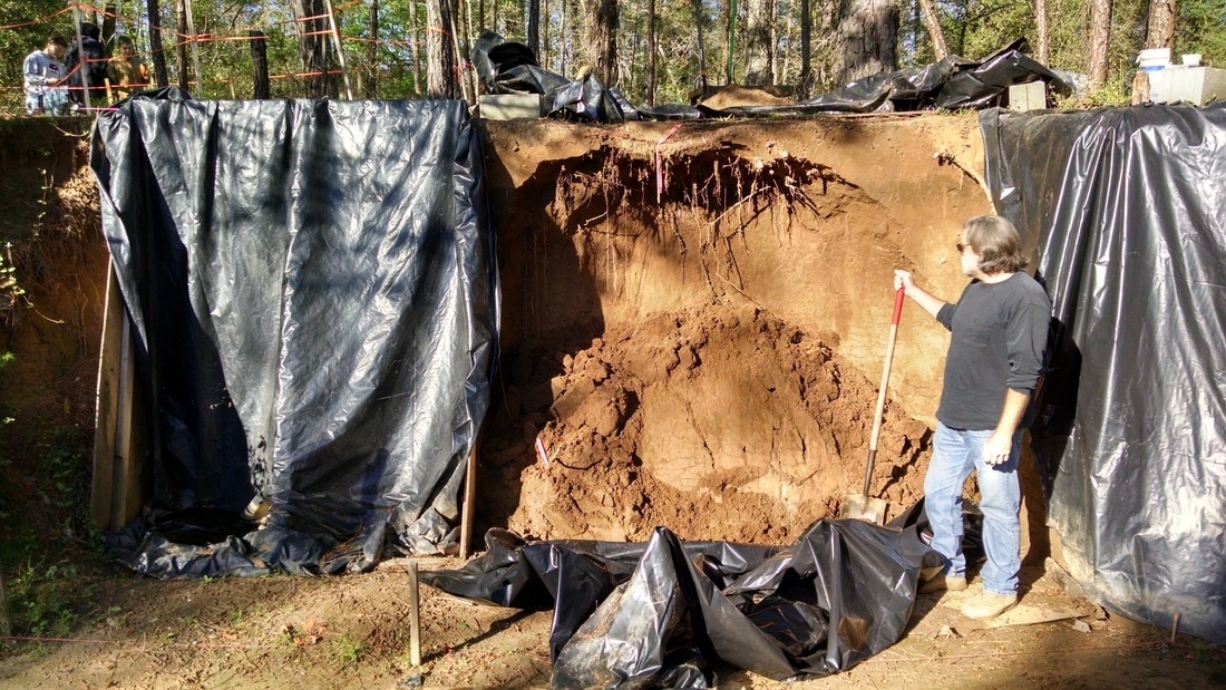
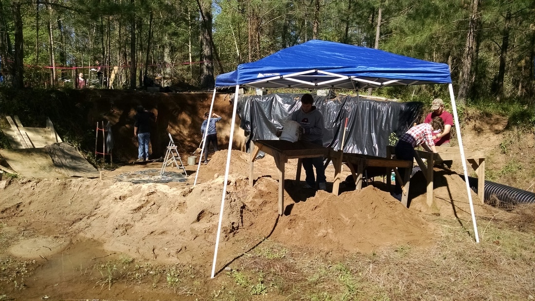
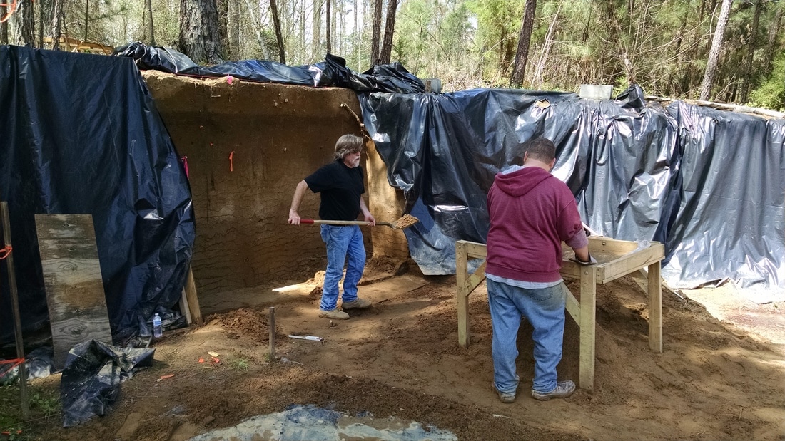
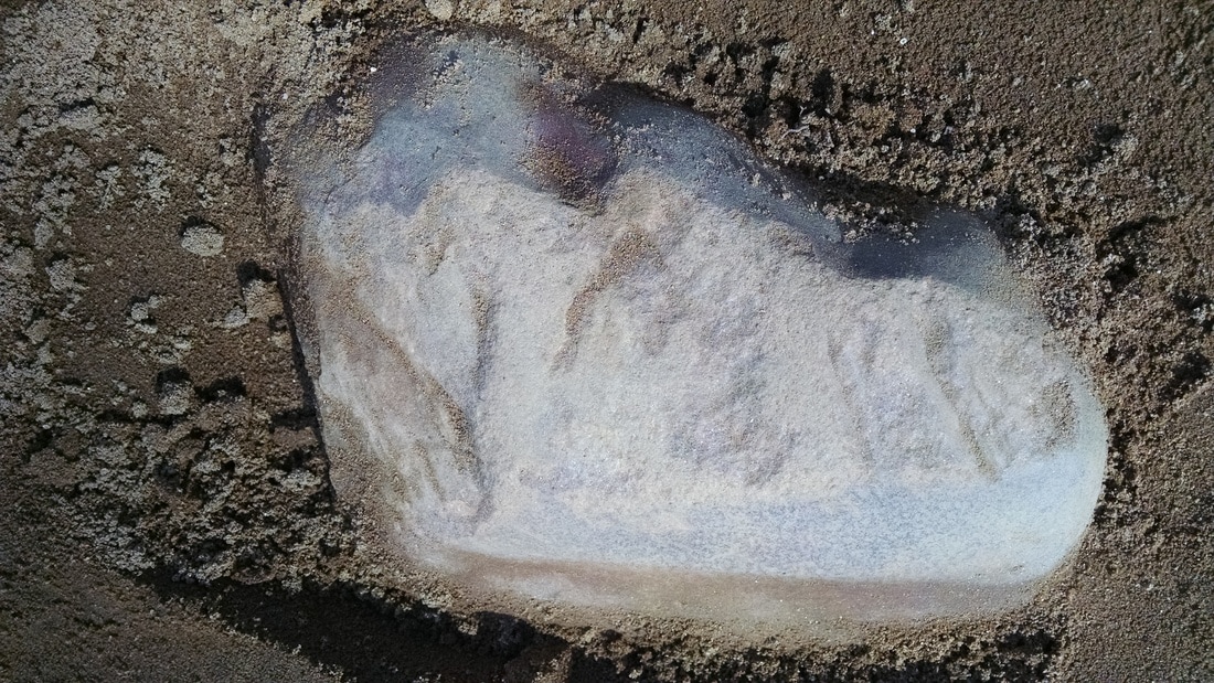
While everything went smoothly in the "upstairs," the "downstairs" portion of the site continued to fight back. DuVal and I visited the site mid-week to deliver a load of lumber for building the buttressing that will protect the profile wall until I can return to it again. I took that opportunity to try to salvage a decent photo of the deposits exposed in the wall after the collapse -- DuVal and I scraped it as best we could and waited for the sun to move to provide natural shade (early afternoon). It's not a perfect picture, but it wasn't a perfect situation. 
Picture
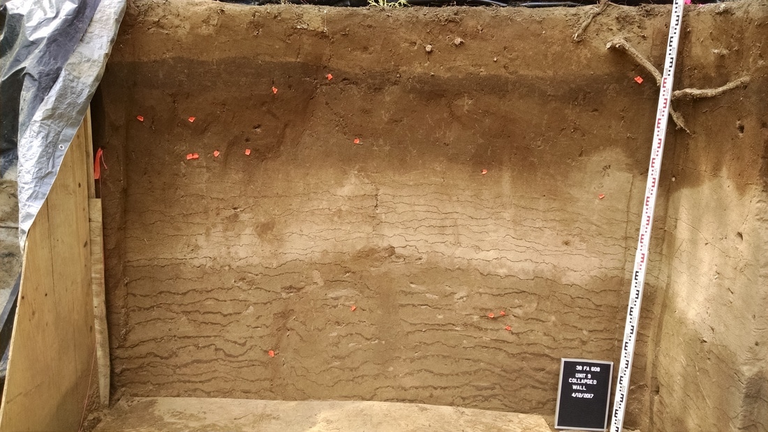
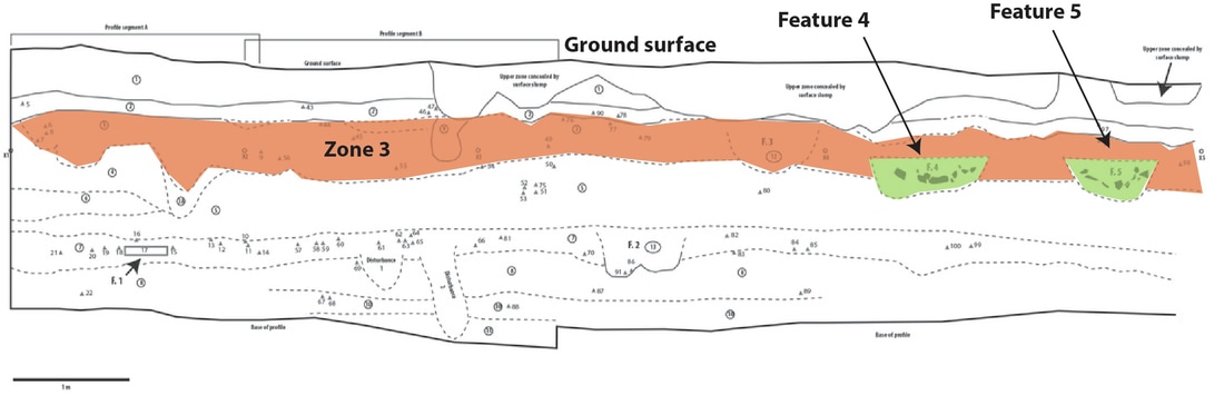
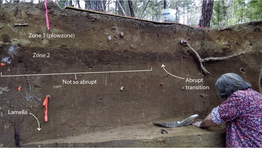
Photograph of profile exposed by the Unit 9 wall collapse. Five main zones are clearly visible. The slightly darker zone that I presume dates to the Middle/Late Archaic doesn't show up well in this photo; it's in the upper potion of the bottom, lamellae-filled zone.
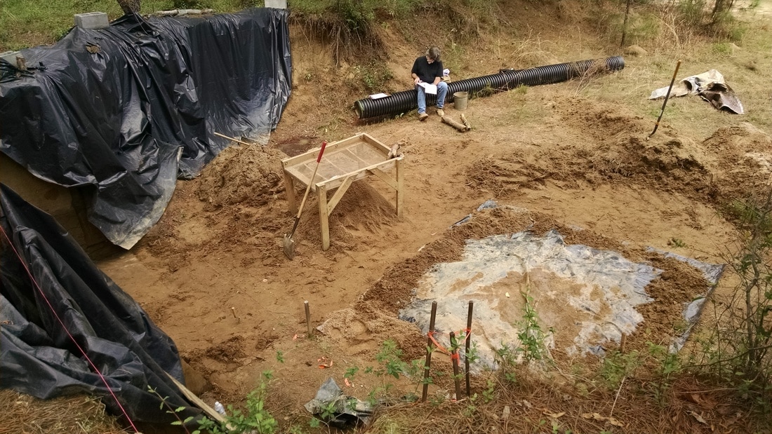
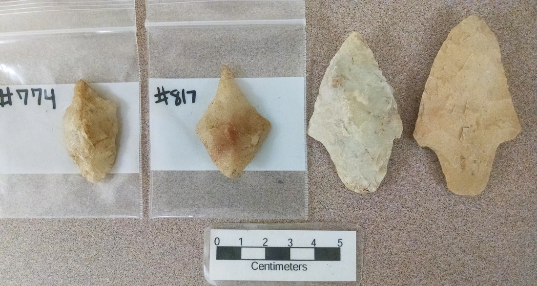
On Friday, Jim Legg completed his profile drawing of the intact north wall of Unit 9 and drew the profile exposed by the wall collapse. You can't really tell from the photo, but the surface is fairly irregular. In order to make it possible to build a wooden structure to protect the profile from further damage, I had some students cut back some portions of the lower zones to produce a surface closer to a vertical plane.  We screened the sediment. I was hoping that perhaps we'd finally get a diagnostic artifact from those lower zones. But, alas, no.
Picture
Big doings "downstairs:" Duval builds, students excavate, and Jim ponders.
By the end of the day this coming Friday, the excavated portion of the "downstairs" profile wall will be protected behind wooden buttressing, one way or another. We'll line the wall with landscape fabric, install vertical wooden panels, and then fill the space between the two with sand. It would have been a lot easier to do this, of course, if the Unit 9 wall had not collapsed. The more irregular the wall, the more sand is required to fill in the spaces. More sand means more pressure on the wall, which requires more strength. The Unit 1 and 2 walls were already uneven, and the bottom part of the reconstructed buttressing there suffered a blowout during backfilling. I think we'll end up piling sand on the bottom portion of the buttressing to counter-act the pressure pushing outward. If there's one thing we have a lot of, it's sand.

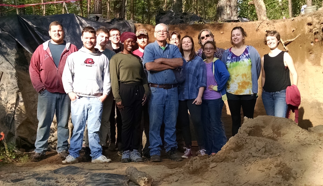
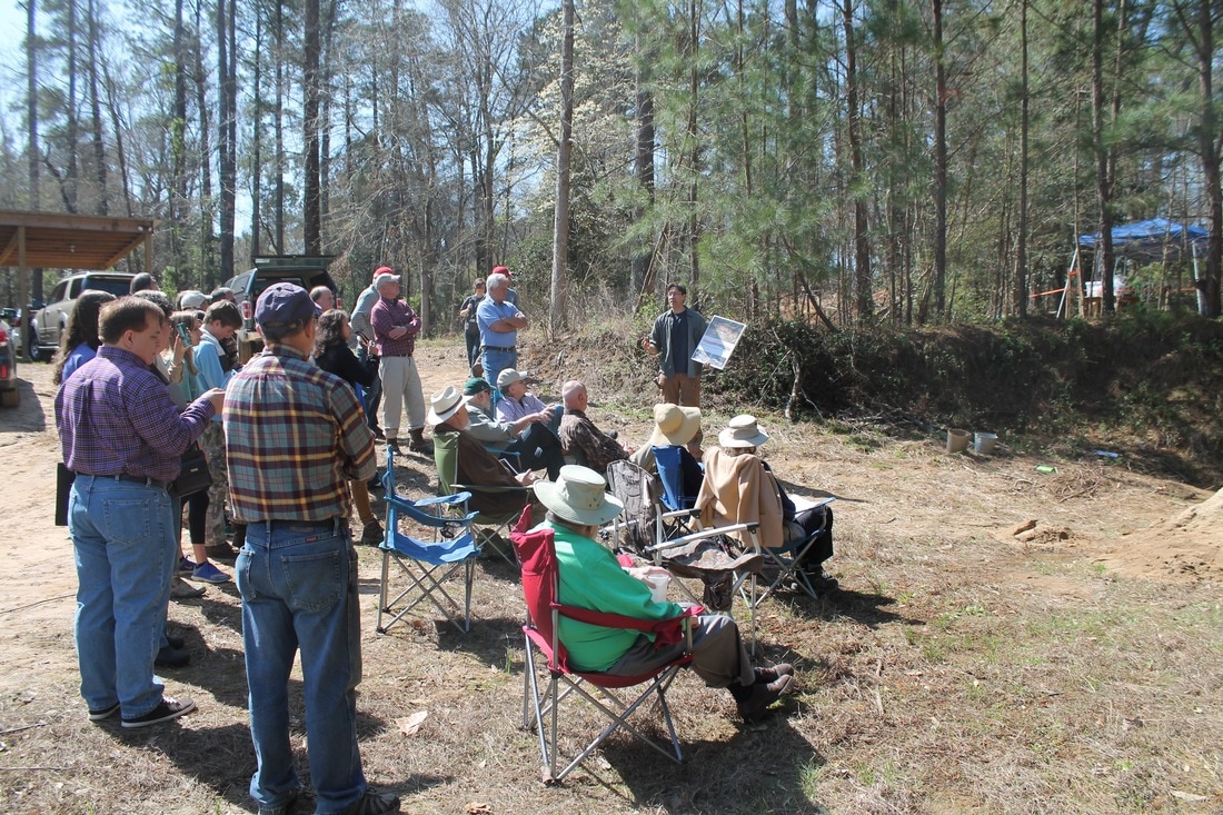
Finally, I was happy to get a group photo with everyone in it. Good job, 2017 Broad River Archaeological Field School!
Picture

Broad River Archaeological Field School: Day 12 (4/7/2017)

4/8/2017

 
If you've ever done any kind of fieldwork, you know that collecting data out in the real world is different from collecting data in the lab.  You control what you can control, but the real world will always be unpredictable and sloppy in ways that are usually not helpful.  An important part of learning to do field archaeology is learning to plan, anticipate, prepare, and quickly adjust to figure out how to meet your goals even when the real world doesn't seem to want to cooperate.

Yesterday was one of those days when the real world threw us an elbow.

For the most part, t
hings have been going surprisingly smoothly during this field school: the students have been great, the information we're collecting is of significant value, and we've barely lost any time to weather. As I wrote last week, I formulated a plan to wind down and close things out in good order over the remaining field days. Some parts of that plan still hold. Other parts now require substantial re-working. 

Let's do the good news first.

In the "upstairs' excavation block, Units 4 and 6 and have been leveled off at 100 cmbd (centimeters below datum), the base of level 8. There is lot of material in the floor at this depth that will have to wait until excavations are re-opened at some point in the future. Additionally, the final floor scrape revealed several roughly circular areas of darker, charcoal-flecked sediment that are almost certainly the tops of cultural features. Large pieces of fire-cracked rock are scattered around on the floors of the units. 
Picture
Base of level 8 (100 cmbd) in Unit 4. Large pieces of fire-cracked rock are scattered around an area of dark, charcoal-flecked sediment that is probably the top of a pit feature. (Note; the photoboard says 'level 6' - that's an error).
I had the students draw the large rocks and the stains on a single plan map for the two units, which are at the same depth. My guess is that we're seeing pit features similar to those exposed in the machine-cut profile wall at about this depth. Depending on the vertical integrity of these deposits (i.e., how much artifacts have been moved around vertically from where they were originally deposited), the features may pre-date the Mack component  or may be a part of it. We won't have an answer to that until the features and the surrounding deposits can be excavated. I'm not going to assign feature numbers to these stains until I have a chance to work on them further -- a few more centimeters of depth in these units will probably help resolve the stains into discrete features, allowing them to be confidently defined in plan and excavated.
Picture
A refresher of the original profile of the machine cut. Features 4 and 5 (pit features lined with fire-cracked rock) are at a similar depth the probable features exposed in the floors of Units 4 and 6 in the block.
Unit 5 is also coming to a close. The base of that unit will rest at 80 cmbd.  The large rocks in the floor will remain until the next time the unit is opened.

And now for the bad news.

The beautiful 3m-long profile wall that Jim Legg has been working on all semester suffered a major collapse while we were gone during the week.  It doesn't look to me like the severe weather we had on Wednesday had anything to do with the collapse: there was no evidence that water had come in from the top or eroded the wall at the bottom. It appears, rather, as though the soft sands of Zones 3 and 4 just decided they didn't want to be on the wall anymore. They may have lost their cohesion as they dried out, sloughing off about 25-50 cm of the wall into a large pile of slump.
Picture
The damage to the west wall of Unit 9. The technical term for this is "total bummer."
The collapse came at a particularly painful time, as we were planning cleaning and photographing the entire 5m profile that morning in preparation for drawing the whole thing. I was even planning on taking the field school photograph with the beautiful profile wall as a backdrop.  Obviously, a change of plans was required both for the day and for the field school exit strategy.

The first thing to do was deal with the sediment from the collapse. We moved some screens into place and pulled some students from the "upstairs" block to move and screen the dirt. Even though the artifacts were now out of vertical context, anything in the slump still has the potential to tell us something about the occupations of the site (we still don't have any diagnostic artifacts from context in the lower deposits, for example, so an Archaic projectile point from the slump would help us understand the sequence of deposits even if we didn't know exactly where it came from). We went ahead and chopped out the overhanging near-surface sediments, as their presence would make protecting the profile more difficult.
Picture
Dealing with the collapse.
The profile of Units 1 and 2 (protected behind plywood since last May) still needed to be dealt with, and the north wall of Unit 9 was intact. DuVal and I removed my plywood buttressing from the Unit 1/2 wall and found that it was pretty much as I left it, which was a relief. Also, the nest of snakes that I had dreamed would be behind the wall was absent. Jim Legg scraped down that surface (which was partly excavated on the 1000 E line and partly a concave surface left by the original machine excavation) and two students made a profile drawing after we photographed it in the afternoon.
Picture
Students draw the profile of Units 1/2 (left) while Jim Legg prepares the north wall of Unit 9 to be photographed. In this photo, all the slump has been removed from the Unit 9 wall collapse.
Needless to say, the circumstances we faced yesterday in the field were not what I would have chosen. My vision of having that entire 5m profile all open and clean at once decisively (and literally) collapsed. It's a setback, of course, but in reality we didn't lose that much information. As it stands now, the 3m profile can still be cleaned, photographed, and described in a way that will add significantly to what we know about the deposits at the site and provide context to the artifacts recovered through the excavation of Unit 9. It won't be as nice as having a profile all along the 1000 E line, but I'm not sure it will make a whole lot of difference in the long run. I'm formulating a plan for dealing with the profile that will allow me to securely protect it until I can return to it with a crew again and get it all in good shape for the future.

On another "glass half full" note, I want to say that I was very happy with the way my students handled themselves yesterday. I asked several of them to switch gears several different times to help out as we dealt with the collapse and the aftermath. They all responded, pitched in, and helped when and where requested. The students "upstairs" finishing up the block units did almost everything on their own, from uncovering the units in the morning to covering them back up at the end of day. I went up there sporadically to assess things, make strategic decisions, and give tactical advice.  But for the most part they did it themselves. As a teacher, it's a great feeling to see them at this level of competence and independence -- they've come a long way from what they could do on that first day we went out there. That's a win.

Broad River Archaeological Field School: Day 11 (3/31/2017)

4/4/2017

 
It's the end of March, which means the dogwoods are blooming, the dragonflies are back, and it's time to start sweating. After an early morning thunderstorm, the temperature cracked 80 degrees on Friday.
Picture
As I wrote last week, the last days of this endeavor will be devoted to collecting some final, crucial pieces of information and then buttoning up the site so that the deposits are protected until we're ready to excavate again.

In the "upstairs" block, it's now evident that excavations in Units 4 and 6 will terminate at the base of level 8 (100 cm below datum [cmbd]). I had hoped to get one more 10 cm level done in those units, but the density of artifacts to piece-plot has not decreased and the best thing to do is to aim for a good ending with a flat floor at the end of the levels.  
Picture
Work continues in the "upstairs" block.
In Unit 5, meanwhile, my plan is to terminate level 6 at 80 cmbd. To the disappointment of the students, the large rock will remain in the floor as it is still immobile at that depth (i.e., we have not reached the depth of the original surface on which the rock was placed). The top of another good-sized rock has appeared in close proximity to the first rock.  It will also have to wait until next time.
Picture
The plow-scarred rock in Unit 5 (and its smaller companion) will have to wait until next time.
We're also preparing for the endgame in the "downstairs" portion of the site. Jim Legg finished his excavation of Unit 9, exposing a full 3 m of clean, plumb profile wall. On our next day in the field we'll dismantle the wooden buttressing that has been protecting the 2 m section of wall to the south of Unit 9. We'll clean and document the entire 5 m at once. It will probably take most of a day to prep and photograph the wall, and at least another day to draw and describe everything.
Picture
Jim Legg nears completion of the excavation of Unit 9.
In conjunction with analysis of the artifacts excavated from the "upstairs" units and Units 8 and 9, the new wall profile will help us add considerable detail to our understanding of how this landform developed and change through time. I'm hoping to have money for several radiocarbon dates to help nail down the absolute chronology of the upper 2.2 meters of deposits.

What lies below the exposed profile remains an open question. The excavation of Unit 7 demonstrated both that artifacts are present and the lamellae cease within about 60 cm of the base of the profile. I had hoped to take Unit 7 down farther to get a better look at what's down there, but water damaged the unit two weeks in a row. The sand is very loose, and the ground surface at the base of the profile is the lowest spot around.  Water collects in the area during a heavy rain, and it takes very little water to erode the unit walls. After deciding that a "deep look" would require a concerted effort that would us to excavate quickly and continuously, we lined the remains of Unit 7 with landscape fabric and filled it back in. I hope to return a later date with a small crew and make a concerted effort to go deep and see if there's an Early Archaic component hiding down there.
Picture
View of the "downstairs" from the "upstairs." I'm considering moving the backdirt to build a big, beautiful wall across the mouth of the cut. I may or may not be able to make Mexico pay for it.

Broad River Archaeological Field School: Day 10 (3/24/2017)

3/30/2017

 
Our tenth day in the field was unusual in that the focus of the day (for me, anyway) was a site visit by the board of the Archaeological Research Trust (ART), the landowner and family, and other guests. As I wrote last December, funds supplied by ART are supporting staff wages in the field and laboratory, as well as the costs of expendable field supplies and the lumber required to build protection for the vulnerable parts of the site. It was my pleasure to show them their money in action and try to communicate why what we're doing is worthwhile.
Picture
My presentation about the discovery of the site and what we know so far about what it contains. Yes, I made visual aids. (Photo by Nena Rice).
In terms of the archaeology, we're now to the point were we need to dial in the exit strategy for the semester. We've got four field days remaining, weather permitting.

"Upstairs," the last day will be spent backfilling the units and making sure everything is buttoned up and protected until the next opportunity to excavate. The second-to-last day will be devoted to drawing profiles of all the unit walls. That leaves us just two more days to excavate. Although I'm very curious to see what the deposits look like below the Mack zone, I'm not prepared to alter the piece-plot strategy at this point in order to speed things up. I think continuing to gather high resolution information as we excavate the Mack component will pay off during analysis. At the rate we're going, we may finish just one more 10 cm level in each of Units 4, 5, and 6.

"Downstairs," the end game will include cleaning, photographing, drawing, and describing the 5 m-long, 2.2 m-high profile that will be exposed when Jim Legg completes the excavation of Unit 9. With only one or two more levels to go to expose the base of the profile in Unit 9, we hope to be prepared to remove the wooden buttressing from Units 1 and 2 and clean and photograph the entire profile after one more day in the field. Drawing the profile will take at least a day. Constructing the buttressing to protect the entire 5 m will take at least part of a day. With luck, we'll be done with the downstairs before we're done upstairs.

I'm also starting to formulate my future plans for work at the site. I'll write about those plans when they're done cooking.

Broad River Archaeological Field School: Day 9 (3/17/2017)

3/20/2017

 
After a week off for spring break, the field school returned to the Broad River to continue excavations at 38FA608. We're in the thick of things now. Unfortunately, the student who brings a coffee maker was absent.

It's slow going in the excavation block. During our previous day in the field, we began getting into what appeared to be a Late Archaic / Early Woodland deposit in Units 4 and 6. That day ended with numerous artifacts marked in place on the floors of those units. The crews in those units spent most of the latest field day dealing with those artifacts, plotting and collecting each one. ​
Picture
Work in progress in the "upstairs" excavation block.
Unit 6 (upper left in the photo above) produced the bases of two heavily reworked Mack points in context, along with numerous pieces of chipped stone debris and fire-cracked rock. We've seen nothing yet in those units that suggests a discrete feature. Unit 4 has produced some ceramic debris in the "Mack" deposit, but I have yet to see any large pieces or pieces with decoration (that doesn't mean we won't found them or even that we haven't already -- the students are plotting hundreds of artifacts and I'm not looking at each one as it comes out of the ground).
Picture
The two heavily reworked Mack points from Unit 6 (left) compared to two less reworked Mack points from Aiken County (right). The presence of points that have been worked down to almost nothing but the haft region immediately suggests that one of the things people were doing at this site was retooling -- discarding worn tools as they refurbished their equipment.
Picture
A sample of "in progress" paperwork: this map of Level 8 of Unit 6 shows the XY locations of the artifacts that the students are plotting (the depths are recorded elsewhere). You can see the locations of plots 774 (upper left) and 817 (lower right), the two projectile points shown in the photo above.
Progress in Unit 5 was slowed by the presence of two small features (Features 7 and 8). Feature 7 was a small deposit of dark, charcoal flecked sediment that appears similar to Feature 6 that we encountered in Unit 6. Only a portion of Feature 7 was visible in the floor of Unit 5, with the remainder extending into the unexcavated portion of Unit 3.  We documented and removed the portion in Unit 5, and we will catch the profile of the feature in the wall of the unit.

Feature 8 was a circular area of light sediment. We documented it in plan and then bisected it. It appears to be a circular pit with relatively straight sides that extend at least 15 cm from the depth at which the feature was defined. Based on the light fill of the feature, its shape in plan and profile, and the fact that it appeared within Zone 2 (the buried plowzone), the feature is almost certainly a historic period post or auger hole of some kind. We'll need to scoop out the remaining fill to keep any intrusive artifacts from plowzone from contaminating the prehistoric deposits.
Picture
Work resumed on the "downstairs" portion of the site with the return of Jim Legg. Jim and a student continued excavating Unit 9 to produce a straight profile wall. There were no diagnostic artifacts and no sign of any features associated with the presumed Middle/Late Archaic deposit, which was a bummer.  There's still a chance we'll find something in what's left of Unit 9 that can give us a firm handle on time/culture deep in the profile, but it's not looking good at this point. Jim wore black instead of paisley, and I can't completely let go of the idea that his wardrobe choice might have hurt our efforts. (Update [3/21/2017]: Legg has promised to return to paisley when we go in the field this Friday.)
Picture
Unit 9, almost to the base of the profile wall.

Broad River Archaeological Field School: Day 8 (3/3/2017)

3/4/2017

 
It is March, and we have entered pine pollen season here in the South Carolina midlands. For the next few weeks, everything will be dusted yellow. 

In more exciting news, at site 38FA608 on the Broad River we have entered what appears to be an intact Late Archaic/Early Woodland midden in our excavation block.  If my initial diagnosis is correct, we're now (literally) scraping the top of a buried occupation zone that dates to around 1000 BC (i.e., about 3000 radiocarbon years before present, give or take). We've encountered this zone at about 95-100 cm below datum, which translates to roughly 65-70 cm below surface in the block. There is no sign of a heavy occupation zone in the existing vertical profile wall at that depth, so we may be dealing with something that is fairly limited in size (or at least was not distributed evenly across the ground surface that was present 3000 years ago). In that regard, this was a bit of a surprise, but it's the good kind of surprise: we're learning more about the kinds, dates, and extents of deposits at this site with every shovel-full of dirt.

​First, the "downstairs." We were without Jim Legg, so work was paused on the profile wall excavation (Unit 9). Two students finished up level 4 of Unit 7, the 1m x 2m unit being excavated to explore below the exposed profile. As I wrote last week, Unit 7 succeeded in locating the termination (or at least a hiatus in) the lamellae that presumably formed as a result of a process of particle migration/accumulation caused by water percolation. In other words, the end of the lamellae may be telling us something about the position of the water table. 
Picture
Unit 7 excavated to the base of level 4.
I'm not done with Unit 7 (I want to take it as far down as I can, as long as things are safe), but I needed to shift people up to the block to finally start excavating Unit 3. Unit 3 is the northeastern 2m x 2m unit in the block.  It has so far remained untouched. As the other units in the block get deeper, they are getting more difficult to enter and exit safely (and without putting stress on the walls). So we began excavating the eastern half of Unit 3 to serve as a step down in the other units. Now that we know the top two zones are plowzones, we can excavate them as natural levels. So it was a return to battling roots for DuVal and a couple of lucky students.
Picture
Work in progress in the block. Units 4 an 6 (right side of photo) are in level 8 (90-100 cm below datum). Unit 5 (front left) is into "good" deposits below zone 2, continuing the shovel-skimming piece-plot methodology. The east half of Unit 3 (back left) is being excavated to make a step.
Things got interesting in the block fairly quickly. Mid-morning, the students working in Unit 6 (shovel scraping through the last bits of their level 7, 75-90 cmbd) exposed a projectile point in the floor of the level. Their instructions for this level were to shovel scrape/skim at moderate speed, watching for stains and color changes and inspecting artifacts they encountered but only marking things for piece-plotting if they were large and/or interesting (i.e., diagnostic artifacts). I'm really happy that the student caught the point in the floor and it was left in place, as it gives us our first lithic diagnostic down in context in the block.
Picture
I think it's a Late Archaic / Early Woodland stemmed form, what we might call "Gary" in the Midcontinent but what is commonly known as "Mack" here. At first glance, the point has the basal shape of a Morrow Mountain (a Middle Archaic form), but I think it's much too high in the deposits to be that old. There is some unfortunate morphological overlap between Early Woodland and Middle Archaic point forms here. I'm going to be exceedingly lazy and just paste in a few paragraphs from Daniel Elliot and Ken Sassaman's (1995) Archaic Period Archaeology of the Georgia Coastal Plain and Coastal Zone (pages 44 and 45): 
Picture
Picture
The Early Woodland period is not something that I've studied extensively, but that may have to change. I was first made aware the issue of morphological overlap between stemmed points from the Middle Archaic and Early Woodland periods (leading to problems identifying points that are not from secure archaeological contexts -- i.e., the vast majority of points) at a party last year, talking to a someone with far more experience in this region than me. I filed her observation away to think about later. I guess now is later.  

Anyway, our work at this site could potentially end up being useful in helping to understand what's going on during the Early Woodland here, both in terms of lithic technology and cultural/social behavior. The zone that we're getting into in the block (partway through Zone 3) probably corresponds to the large pit features exposed in the profile wall. If we don't find any features in the block at this depth, it is only going to increase my desire to rescue what is left of those features from the profile. That would entail excavating a roughly 3m x 3m unit down from the top of deposits -- not a trivial undertaking. It would give us three more meters of vertical profile and would expose the remainder of the features in plan view. It would be a big time/energy commitment, and I don't think I can get it done during the field school. I may change my mind, however. 
Picture
My profile of the irregular machine cut, showing features originating in Zone 3. If my diagnosis is correct, those features probably date to the Late Archaic / Early Woodland.
After documenting the base of level 7 (at 90 cmbd), the students in Units 4 and 6 moved into the excavation of level 8. At the base of level 7 in Unit 6, the sediment appeared to be darker in the southeast corner of the unit. The boundary was too diffuse to define it as a feature, though, so I had the students map and describe it as a separate sediment zone. Scraping the floor at the beginning of level 8 immediately produced a good amount of material in that corner, including another point with a contracting stem. In Unit 6, they started encountering some large pieces of fire-cracked rock and lots of flaking debris. At first I thought we were might be coming down on a couple of features (one in each unit). After investigating further, however, it appeared more likely that we were just hitting the irregular top of a continuous zone that probably extends across the entire block. It was time to put on the brakes and return to a slower, more intensive piece-plotting strategy. Given that all the students have now experienced the joys of piece-plotting by hand, I'll probably fire up the total station next time we're out and begin using it to collect piece-plot coordinates electronically. 

Excavations in Unit 5 are a currently about 20 cm behind those in Units 4 and 6. Given what we now know is on the horizon for Unit 5, my plan is to continue the intensive piece-plotting excavations in that unit all the way down. At 75 cmbd, there's a possible feature to deal with (it looks fairly similar to Feature 6, the small charcoal-flecked basin we excavated in Unit 6 last week). The large, plow-sheared rock in Unit 5 remains in the floor, as we still haven't reached the surface that it's sitting on (thankfully, no-one has tripped over it yet). It will be interesting to see what, if anything, is around it when we reach the depth that would have been the surface when it was deposited.
Picture
Excavations in progress in the block. It's starting to get a little crowded in there with everything and everyone going at once.
Finally, we encountered our third serpent of this field school: a tiny snake that was sleeping under one of our plywood edge protectors. I moved it to a safe spot.
Picture

Broad River Archaeological Field School: Day 7 (2/24/2017)

3/1/2017

 
Last Friday marked the halfway point of the field school. We have accomplished a lot in seven days of work, and it's a pleasure to watch the students continue to become more and more comfortable and competent with the strategies, methods, and techniques of basic archaeological excavation.

In the "upstairs" portion of the site, excavations in Units 4 and 6 continued into the deposits beneath Zone 2. In Unit 6, we dealt with a small feature (designated Feature 6) that appeared beneath Zone 2.

A cultural "feature" is basically an immovable artifact -- an "in place" deposit created by human activity. In this part of the world, cultural features include the remains of such things as hearths, storage pits, cooking pits, postholes, burials, etc. Because intact features contain a record of a discrete set of human activities that occurred over a relatively short span of time, they hold valuable clues about what people were actually doing at a site. We love features because they give us specific information that other kinds of deposits cannot.
Picture
Feature 6 in plan view prior to excavation, with lines scribed for mapping. The inner zone of the feature consisted of a circular/elliptical stain that contained a moderate density of charcoal. The outer zone was probably a "bleed" area created by natural processes (worms, insects, and roots) mixing parts of the feature with the surrounding sediment. The nails and string mark the line along which the feature will be excavated and profiled.
As you can see from the photo above, Feature 6 was a rather unspectacular stained area that contained a moderate amount of charcoal. We used standard feature excavating techniques to document and remove the feature: (1) mapped and described it in plan view; (2) bisected it to expose a profile, screening the sediment through 1/4" mesh; (3) documented the profile; (4) removed the remaining portion of the feature as a flotation sample. There wasn't much cultural material in the feature, but there were lots of large chunks of charcoal. In profile the feature appeared to be a shallow basin with a fairly regular shape, and there was no evidence that it was a root stain or rodent burrow.
Picture
Students excavating and documenting Feature 6.
The excavation to expose Feature 6 in profile went down to about 90 cmbd (centimeters below datum), so that seemed like a good target for the bottom of level 7 in Units 4 and 6. By the end of the day, Unit 6 was well on the way to being there, with no sign of cultural features. We're using a shovel-scraping methodology that, hopefully, strikes a good balance between speed and control. I want to go slow enough to recognize cultural features if they're present, but fast enough to end up with some good data on what we're dealing with as far as the horizontal and vertical distribution of prehistoric materials.
Picture
Work in progress in the block.
Meanwhile, Unit 5 -- the third 2m x 2m unit in the "upstairs" block -- finally got to the base of Zone 2. If there was any remaining doubt that Zone 2 was plowed, those doubts were removed by a large stone exposed at the interface of Zones 2 and 3 in Unit 5.  This rock -- the biggest one I've seen at the site so far -- was undoubtedly brought to the site by prehistoric peoples. While the rock is resting securely in situ in Zone 3 sediments, its top has been sheared off and scraped multiple times by a plow (individual plow scars are visible). If there was ever "smoking gun" evidence of plowing, this is it.
Picture
Large rock at the interface of Zones 2 and 3 in Unit 5. The rock is in situ, and the top has been scraped by plowing.
Meanwhile, in the "downstairs" portion of the site, work resumed on the excavation of Unit 9 (the 1m x 3m unit placed to extend the profile wall. As excavations near the top of the (supposed) Middle/Late Archaic zone, Jim Legg dazzled the students with yet another paisley shirt. Work also continued in Unit 7, a 1m x 2m unit being excavated to explore what lies beneath the exposed profile.
Picture
Work in progress in Unit 9 (left) and Unit 7 (lower right).
The last level of Unit 7 contained very little material. It did reveal, however, that the lamellae (the dark bands of sediment caused by the downward migration and accumulation of clay particles) appear to end rather suddenly. The base sediment remains coarse sand. It's possible that the abrupt ending of the lamellae is telling us something about the level of the water table: saturated sediment would presumably not facilitate the downward migration of clay particles. This will be something we can investigate with sediment analysis once we've got a nice profile exposed that we can sample. In the meantime, I've got my fingers crossed that we don't get a significant rainfall that presses the pause button on Unit 7.

Broad River Archaeological Field School: Day 6 (2/17/2017)

2/20/2017

 
On of the main questions in play over the last couple of days in the field concerns the nature of Zone 2, the dark zone of sediment present immediately beneath the plowzone. I vacillated on whether it was a second, buried plowzone or an intact, prehistoric cultural deposit (i.e., a thin midden). Because I wasn't sure either way, I erred on the side of excavating it as though it was an unplowed deposit, having the students shovel skim and piece-plot.

This Friday, we finally got to the bottom of Zone 2 in two of the block units (Units 4 and 6). Lo and behold . . . plow scars. So it looks like Zone 2 has been plowed after all. 
Picture
The base of Level 5 in Units 4 and 6, with sediment zone boundaries scribed with a trowel. The dark, linear, parallel stains were caused by pentration of a plough into the lighter zone beneath. It appears as though plowing went in two directions at different times.
Calling Zone 2 a "plowzone" doesn't end my questions about it. For one, there are subtle lenses within the zone (visible in profile) that seem inconsistent with a plowzone and need to be explained.  For two, the variable nature of the boundary between Zones 2 and 3 suggests that, if Zone 2 was originally accumulated as a surface midden, there is the distinct potential that unplowed pockets of the midden remain intact. For three, we need to explain the origin of all the lighter sediment that was somehow deposited on top of Zone 2, burying it and shifting the modern plowzone upward. While I'm not sure we'll be able to answer those questions this field season, I am happy that we've recovered what appears to be a nice little assemblage of Mississippian-age ceramic and lithic debris. 

We're removing the last remnants of Zone 2 with a shallow level (Level 6, about 5 cm in depth) intended to get rid of the plowscars and level the units off at an even 75 cm below datum. As of the end of the day on Friday, Level 6 was in progress in Units 4 and 6. Unit 5 was finishing up the last of their Zone 2 level (Level 4 in that unit).
Picture
Work in progress in the block.
With Zone 2 removed, we'll now be able to press downward and get a look at what's beneath it. In the wall left by the original machine cut, two good-sized pit features (Features 4 and 5 in the profile drawing) originate in Zone 3. Intact cultural features (i.e., hearths, postholes, pits) should be relatively easy to discern against the fairly light matrix of Zone 3.​
Picture
Profile of machine cut showing Zone 3 and locations of Features 4 and 5 which originate in Zone 3.
With work just beginning below Zone 2, it already looks different. In Unit 6, the top of Zone 3 has revealed a couple of large (golf ball-sized) pieces of fire-cracked rock and a charcoal-rich stain that could be the top of a cultural feature. We'll learn more about Zone 3 during our next day in the field.

Meanwhile, in the "downstairs" portion of the site, we finally opened Unit 7 (Jim Legg could not join us, so work on Unit 9 was paused). Unit 7 is a 1m x 2m unit placed to investigate what, if anything, is beneath the deposits exposed in the machine cut.  While the short answer, so far, is "not much," the deep sediments are not sterile: there was at least one piece of fire-cracked rock in the second level of Unit 7. I'm not anticipating we'll run into a heavy prehistoric deposit, but at this point we don't have any data about what's down there other than a single exploration I did with a 3" bucket auger.  A few more levels in Unit 7 have the potential to tell us quite a bit, as even a relatively sparse occupation will probably be detectable in levels from a 1m x 2m unit.
Picture
Work begins on Unit 7. Elevations for this unit are controlled the old-fashioned way, using a notched stake, line level, and string.

Broad River Archaeological Field School: Day 5 (2/10/2017)

2/13/2017

 
We had another sunny Friday with highs in the mid-50's. I saw a bee over the weekend, so it looks like the worst of another brutal South Carolina winter is behind us.

As I wrote last week, my hope for this Friday was that we would end the day being able to say with some confidence whether Zone 2 (the dark zone beneath the plowzone) is a buried plowzone or an intact cultural deposit. Unfortunately, I still don't have definitive evidence either way.  Based on the day's work, however, I'm now leaning more toward the idea that we are, in fact, dealing with an unplowed prehistoric deposit.

If Zone 2 is a buried plowzone, we'll expect to see some evidence of plowing (e.g., plow scars or plow-truncated features) at the interface between the base of the zone and the underlying sediments. We're not to that interface in any of the block units yet, however.

Because I don't know what Zone 2 is, I had the students excavate it using a shovel-skim/piece-plot methodology. Shovel-skimming involves using shovels to carefully remove thin (e.g., 1/4" to 1/2") slices of sediment. This technique allows you to leave larger artifacts in place as you find them and keep an eye out for changes in sediment color and texture that could be associated with cultural features such as hearths, pits, or postholes. I had the students leave artifacts in place as they encountered them, marking them with a piece of orange flagging tape stuck in the ground with a nail. When the floor became too cluttered with artifacts, artifacts were piece-plotted (mapped individually) and removed. All the sediment that was removed with shovels was passed through 1/4" screen to catch smaller artifacts that weren't detected during the shoveling.​
Picture
Shovel-skimming and piece-plotting of Zone 2 in the block units. Pieces of orange flagging tape mark artifact locations.
If Zone 2 turns out to be a buried plowzone, our careful excavation of it will have been largely an educational exercise (shovel skimming and piece-plotting are techniques that the students need to learn regardless, so that's fine). If it turns out to be an intact Mississippian midden deposit, however, I'll be happy that we excavated through it in a way that may help us learn something about its formation. The deposit has produced several rim sherds and at least one fragment of a pipe bowl. So far, there has been no sign of features originating within the deposit.
Picture
Rim sherd in situ. The rim edge is facing toward the top of the photo.
One of the pieces of information that has me thinking that Zone 2 may be a prehistoric midden is the view now available in the wall of Unit 9.  Last week, I pointed at a small section of the base of Zone 2 and noted that it was more abrupt than one would expect in a naturally-formed sediment zone. On Friday, however, I took another look at the Unit 9 wall that Jim Legg is working on and it appears that that abrupt "straight" segment is more the exception than the rule. There also appear to be thin horizontal lenses of sediment within Zone 2, the presence of which seems inconsistent with a plowed deposit.
Picture
West wall of Unit 9, excavation in progress.
As shown in the photo, the excavation of Unit 9 is now down into the portion of the profile where lamellae become visible. These lamellae -- thin layers of clay-enriched sediment -- become thicker and more pronounced with depth in the profile.  They are formed by the movement and accumulation of clay particles (here is an online article to get you started if you want to learn more about lamellae). Jim's excavation has yet to produce any diagnostic lithic artifacts (he's below the depth at which we're still expecting to find pottery) or evidence of intact features. He'll be down to the depth of what I think is a Middle/Late Archaic zone in a few more levels.
Picture
The weekly photo showing the excavation of Unit 9 in progress.

Student Blog Posts from the First Three Days of the Broad River Archaeological Field School

2/5/2017

 
This is just a quick post to point you in the direction of the student blog section of the Broad River Archaeological Field School website. Blog posts from our first three days of work are online.
Picture
Three students are assigned to write posts for each day we're in the field. Their posts from the previous week are due on Thursday morning, so typically I'll hope to have them posted by the end of the day on Thursday. An emergent issue kept me busy last Thursday, but the new posts from Day 3 are up now. Enjoy!
<<Previous
Forward>>

    All views expressed in my blog posts are my own. The views of those that comment are their own. That's how it works.

    I reserve the right to take down comments that I deem to be defamatory or harassing. 

    Andy White

    Email me: [email protected]

    Enter your email address:

    Delivered by FeedBurner


    Picture

    Sick of the woo?  Want to help keep honest and open dialogue about pseudo-archaeology on the internet? Please consider contributing to Woo War Two.
    Picture

    Follow updates on posts related to giants on the Modern Mythology of Giants page on Facebook.

    Archives

    May 2024
    January 2024
    January 2023
    January 2022
    November 2021
    September 2021
    August 2021
    March 2021
    June 2020
    April 2020
    March 2020
    January 2020
    December 2019
    November 2019
    October 2019
    September 2019
    May 2019
    April 2019
    January 2019
    December 2018
    November 2018
    October 2018
    September 2018
    August 2018
    July 2018
    June 2018
    May 2018
    April 2018
    March 2018
    February 2018
    January 2018
    December 2017
    November 2017
    October 2017
    September 2017
    August 2017
    July 2017
    June 2017
    May 2017
    April 2017
    March 2017
    February 2017
    January 2017
    December 2016
    November 2016
    October 2016
    September 2016
    August 2016
    July 2016
    June 2016
    May 2016
    April 2016
    March 2016
    February 2016
    January 2016
    December 2015
    November 2015
    October 2015
    September 2015
    August 2015
    July 2015
    June 2015
    May 2015
    April 2015
    March 2015
    February 2015
    January 2015
    December 2014
    November 2014
    September 2014
    August 2014
    June 2014
    May 2014
    April 2014
    March 2014

    Categories

    All
    3D Models
    AAA
    Adena
    Afrocentrism
    Agent Based Modeling
    Agent-based Modeling
    Aircraft
    Alabama
    Aliens
    Ancient Artifact Preservation Society
    Androgynous Fish Gods
    ANTH 227
    ANTH 291
    ANTH 322
    Anthropology History
    Anunnaki
    Appalachia
    Archaeology
    Ardipithecus
    Art
    Atlantis
    Australia
    Australopithecines
    Aviation History
    Bigfoot
    Birds
    Boas
    Book Of Mormon
    Broad River Archaeological Field School
    Bronze Age
    Caribou
    Carolina Bays
    Ceramics
    China
    Clovis
    Complexity
    Copper Culture
    Cotton Mather
    COVID-19
    Creationism
    Croatia
    Crow
    Demography
    Denisovans
    Diffusionism
    DINAA
    Dinosaurs
    Dirt Dance Floor
    Double Rows Of Teeth
    Dragonflies
    Early Archaic
    Early Woodland
    Earthworks
    Eastern Woodlands
    Eastern Woodlands Household Archaeology Data Project
    Education
    Egypt
    Europe
    Evolution
    Ewhadp
    Fake Hercules Swords
    Fetal Head Molding
    Field School
    Film
    Florida
    Forbidden Archaeology
    Forbidden History
    Four Field Anthropology
    Four-field Anthropology
    France
    Genetics
    Genus Homo
    Geology
    Geometry
    Geophysics
    Georgia
    Giants
    Giants Of Olden Times
    Gigantism
    Gigantopithecus
    Graham Hancock
    Grand Valley State
    Great Lakes
    Hollow Earth
    Homo Erectus
    Hunter Gatherers
    Hunter-gatherers
    Illinois
    India
    Indiana
    Indonesia
    Iowa
    Iraq
    Israel
    Jim Vieira
    Jobs
    Kensington Rune Stone
    Kentucky
    Kirk Project
    Late Archaic
    Lemuria
    Lithic Raw Materials
    Lithics
    Lizard Man
    Lomekwi
    Lost Continents
    Mack
    Mammoths
    Mastodons
    Maya
    Megafauna
    Megaliths
    Mesolithic
    Michigan
    Middle Archaic
    Middle Pleistocene
    Middle Woodland
    Midwest
    Minnesota
    Mississippi
    Mississippian
    Missouri
    Modeling
    Morphometric
    Mound Builder Myth
    Mu
    Music
    Nazis
    Neandertals
    Near East
    Nephilim
    Nevada
    New Mexico
    Newspapers
    New York
    North Carolina
    Oahspe
    Oak Island
    Obstetrics
    Ohio
    Ohio Valley
    Oldowan
    Olmec
    Open Data
    Paleoindian
    Paleolithic
    Pilumgate
    Pleistocene
    Pliocene
    Pre Clovis
    Pre-Clovis
    Prehistoric Families
    Pseudo Science
    Pseudo-science
    Radiocarbon
    Reality Check
    Rome
    Russia
    SAA
    Sardinia
    SCIAA
    Science
    Scientific Racism
    Sculpture
    SEAC
    Search For The Lost Giants
    Sexual Dimorphism
    Sitchin
    Social Complexity
    Social Networks
    Solutrean Hypothesis
    South Africa
    South America
    South Carolina
    Southeast
    Stone Holes
    Subsistence
    Swordgate
    Teaching
    Technology
    Teeth
    Television
    Tennessee
    Texas
    Topper
    Travel
    Travel Diaries
    Vaccines
    Washington
    Whatzit
    White Supremacists
    Wisconsin
    Woo War Two
    World War I
    World War II
    Writing
    Younger Dryas

    RSS Feed

    Picture
Proudly powered by Weebly